

West London’s rivers shape its landscape, historic settlements, parks, wetlands and walking routes. The River Thames forms the region’s main waterway, while the River uk/local/brent/">Brent, River Crane, River Colne and smaller tributaries connect residential neighbourhoods with historic sites and important wildlife habitats.
- What are the main rivers in West London?
- Where does the River Thames flow through West London?
- What is the River Brent and where can it be found?
- What is the River Crane and why is it important?
- Where does the River Colne flow near West London?
- How have West London’s rivers changed throughout history?
- How did canals influence West London’s rivers?
- Why were artificial channels constructed?
- How did urbanisation affect river channels?
- Which West London rivers are best for walking and nature watching?
- What wildlife lives in West London’s rivers?
- Which birds can people see beside the rivers?
- How do rivers support mammals and aquatic species?
- Why are riverside plants important?
- How do West London’s rivers affect flooding and water management?
- Why is the Thames floodplain important?
- How do smaller rivers contribute to flood risk?
- How can residents check river flood warnings?
- What causes pollution in West London’s rivers?
- How are West London’s rivers being restored and protected?
- Why will West London’s rivers remain important in the future?
- How can people explore the rivers of West London?
The rivers of West London also explain how communities developed around water, how industries used river corridors, and how modern authorities manage flooding, water quality and biodiversity. From the Thames at Richmond and hounslow/chiswick/">Chiswick to the Brent through ealing/hanwell/">Hanwell and the Crane through Twickenham, these waterways provide a connected view of West London’s geography and environmental history.
What are the main rivers in West London?
West London’s main rivers include the Thames, Brent, Crane and Colne, alongside smaller streams and historic channels. These waterways drain different parts of the region, connect green spaces, support wildlife and influence settlement patterns, transport infrastructure and flood management.
The river network of West London is part of the wider Thames River Basin, which includes urban districts, suburban neighbourhoods, open countryside and tributaries flowing towards the River Thames. A river catchment is the area of land from which rainfall drains into a particular river and its tributaries.
The principal waterways have distinct geographical roles:
- River Thames: The major river running through Richmond, Kew, Chiswick and Brentford, with tidal conditions extending inland from the Thames Estuary.
- River Brent: A tributary draining parts of northwest and west London before joining the Thames at Brentford.
- River Crane: An urban river flowing through the Hayes, Hounslow, Twickenham and Isleworth areas before reaching the Thames.
- River Colne: A river on the western edge of Greater London, associated with the Colne Valley landscape around Uxbridge, West Drayton and the wider regional park.
- Yeading Brook: A tributary system feeding the River Crane and connecting several green corridors in Hillingdon and neighbouring boroughs.
- Dollis Brook and Silk Stream: Watercourses contributing to the wider Brent catchment through the Brent Reservoir system.
These rivers differ in length, catchment size, channel structure and public accessibility. Some sections retain relatively natural banks and floodplains, while others pass through concrete channels, culverts, industrial land and densely developed residential areas.
The Environment Agency’s Catchment Data Explorer documents the Brent catchment as a connected system of rivers and lakes, including watercourses affected by urban development.
Where does the River Thames flow through West London?
The River Thames flows through West London along a corridor connecting Richmond, Twickenham, Isleworth, Brentford, Chiswick and neighbouring riverside districts. Its banks contain historic settlements, public parks, bridges, commercial areas and wildlife habitats shaped by centuries of human activity.
The Thames is the principal geographical feature linking West London to central London and the wider southeast of England. Its river corridor includes tidal and non-tidal sections, although tidal conditions extend well beyond the central London area.
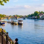
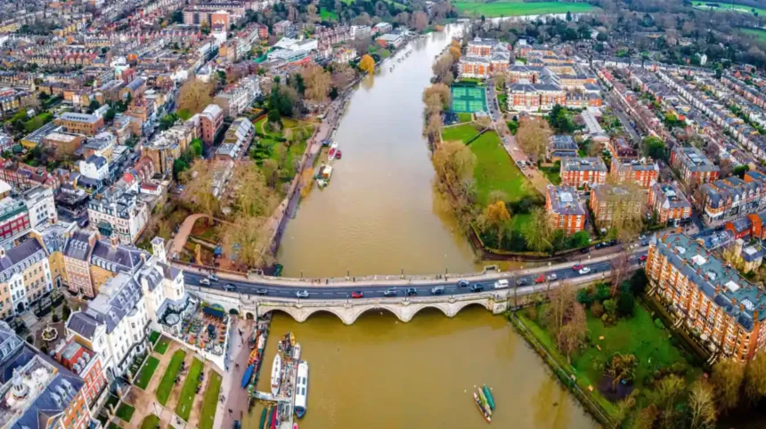
Richmond provides one of the best-known stretches of the river. The Thames passes the town centre, Richmond Bridge and riverside paths, where visitors find views of historic buildings, boats and riverside greenery.
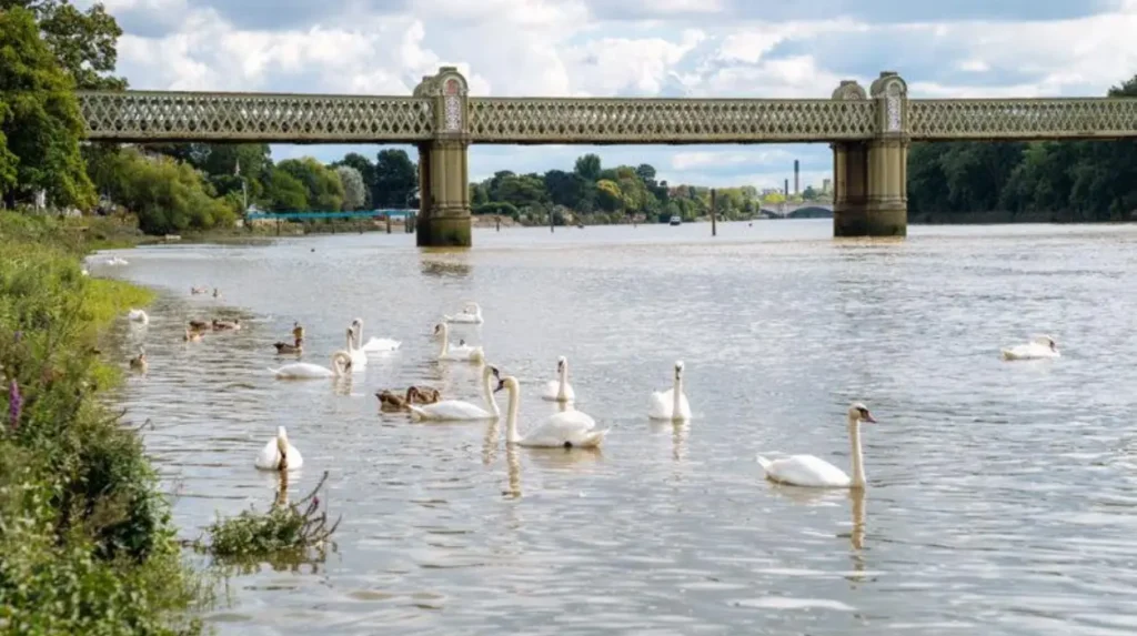
Further east, the river passes Kew and Chiswick. Kew Bridge connects Brentford with Kew, while the nearby Royal Botanic Gardens, Kew, occupies a substantial landscape close to the river. Chiswick’s riverfront includes residential streets, walking routes and historic buildings.
Brentford lies at the mouth of the River Brent, where the tributary enters the Thames. The meeting point reflects the historical importance of waterways for transport, trade, industry and settlement.
The Thames also supports recreation, including walking, rowing, sailing and wildlife observation. Public access varies by location because some banks are private, some paths are affected by tides, and certain sections contain working infrastructure.
Why has the River Thames shaped West London?
The Thames influenced settlement because it provided transport routes, access to water, fishing opportunities and connections to markets. Rivers also supported mills, wharves, boatyards and industries that depended on moving goods by water.
Brentford developed around its riverside position and canal connections. Richmond became known for its historic townscape and riverside landscape. At Chiswick, the river contributed to the area’s identity as a residential and recreational district.
Today, the Thames remains important for public open space, water management, river transport and flood-risk planning. Its floodplain also creates constraints for property development and infrastructure projects.
What is the River Brent and where can it be found?
The River Brent is a major tributary of the Thames that flows through northwest and west London. It passes through the Brent Valley, including Perivale, Greenford and Hanwell, before continuing towards Brentford and its confluence with the Thames.
The River Brent is one of the most significant waterways for understanding the relationship between urban development and green space in West London. Its catchment includes residential neighbourhoods, parks, roads, railway infrastructure and commercial areas.
The river is associated with the Brent Reservoir, commonly known as the Welsh Harp, and a network of tributaries. Dollis Brook and Silk Stream contribute to the wider system. The river also connects with the Grand Union Canal around Hanwell and Brentford.
What is Brent River Park?
Brent River Park is a network of open spaces following a roughly seven-kilometre section of the river through Perivale, Greenford and Hanwell in the London Borough of Ealing.
The park covers more than 400 hectares of open space. Ealing Council identifies it as an important conservation landscape containing formal parks, meadows, sports grounds, allotments and areas of semi-natural habitat.
Important spaces within this corridor include Pitshanger Park, Brent Lodge Park, Hanwell Meadows and Elthorne Park. These areas provide routes for walking and local recreation while preserving green links through built-up neighbourhoods.
The Capital Ring walking route also follows sections of the Brent Valley. This wider London walking route extends for approximately 125 kilometres, or 78 miles, through parks, open spaces and residential areas.
How does the River Brent support local wildlife?
The River Brent and its associated green spaces provide habitats for birds, insects, mammals and amphibians. Riverbanks, trees, grassland and wet meadows offer different conditions for feeding, nesting and shelter.
Mallards and moorhens are examples of waterbirds recorded in parts of the Brent corridor. Other stretches support riverside vegetation, including reeds, shrubs and trees that provide cover for wildlife.
Habitat quality varies along the river. Some sections have natural or semi-natural banks, while others have engineered channels that restrict vegetation and limit access to the water. Maintaining connected green spaces helps wildlife move between habitat patches.
What is the River Crane and why is it important?
The River Crane is an urban river in West London that flows through a catchment spanning five boroughs and supporting more than 650,000 people. Its network of tributaries, wetlands, woodlands and parks provides valuable wildlife corridors within a heavily developed landscape.
The River Crane is particularly important because substantial sections retain natural features despite the surrounding urban development. The Crane Valley Partnership describes the catchment as covering approximately 125 square kilometres, with around 60 kilometres of semi-natural river corridors.
The catchment crosses Ealing, Harrow, Hillingdon, Hounslow and Richmond upon Thames. It includes residential areas, commercial sites, transport infrastructure and large green spaces.
Where does the River Crane begin and end?
The Crane system begins with tributaries including Yeading Brook. Around the Hayes area, the watercourse transitions from the Yeading Brook system into the River Crane, with the change occurring near infrastructure associated with the Grand Union Canal and Great Western Railway.
The river continues through the Hounslow and Twickenham areas before joining the Thames. Its lower reach is tidal between Cole Park and the Thames, according to the Crane Valley Partnership.
The catchment also contains historic artificial channels, including branches of the Duke of Northumberland’s River. These channels reflect centuries of water management and landscape modification.
The Longford River is another historic artificial watercourse in the wider area. It passes through the Crane Valley catchment but does not connect directly to the River Crane.
Which nature reserves protect the River Crane?
Several nature reserves protect habitats associated with the Crane and its tributaries. Examples include Crane Park Island, Ickenham Marsh, Yeading Brook Meadows, Huckerby’s Meadows and Gutteridge Wood.
Crane Park Island, near Twickenham, is particularly associated with the lower Crane. The wider reserve network preserves wetlands, woodland, grassland and riverbank vegetation.
The Friends of the River Crane Environment organisation documents wildlife in the valley, including kingfishers, water voles, eels, bats and tawny owls. These records demonstrate the ecological value of the river corridor, although the presence of individual species varies by site and survey period.
The Crane Valley Partnership coordinates conservation work involving local authorities, charities, community groups, landowners and environmental organisations. Its activities include habitat restoration, improved public access and community participation.
Where does the River Colne flow near West London?
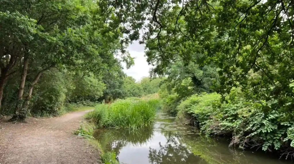
The River Colne flows through the western London fringe and the wider Colne Valley, connecting towns, countryside, wetlands and lakes. Its landscape extends around Uxbridge, West Drayton and neighbouring areas towards the Thames near Staines and the surrounding river network.
The River Colne is a major watercourse in the wider landscape west of London. Its catchment includes rural areas, urban settlements, transport corridors and water-rich landscapes. It is closely associated with the Colne Valley Regional Park, which preserves green space between Greater London and the surrounding counties.
The Colne Valley Regional Park covers approximately 43 square miles. The park’s landscape includes more than 200 kilometres of waterways, over 60 lakes, nature reserves, country parks and open countryside. Its geographical extent runs from Rickmansworth in the north towards Staines and the Thames in the south, and from Uxbridge and Heathrow in the east towards Slough and Chalfont St Peter in the west.
Why is the Colne Valley important for nature?
The Colne Valley contains interconnected wetlands, lakes, rivers, woodland and grassland. This variety of habitats supports aquatic life, waterbirds, insects and mammals.
Nature reserves and lakes provide feeding and resting areas for birds, while vegetation around waterways offers shelter for wildlife. The landscape also contributes to water storage and creates open space near major transport corridors.
The regional park provides access to countryside close to West London. Walking routes and public open spaces allow visitors to explore parts of the water network without travelling far from towns such as Uxbridge and West Drayton.
Public access differs between sites. Visitors need to check individual reserve rules, footpath conditions and seasonal restrictions before planning a walk.
How have West London’s rivers changed throughout history?
West London’s rivers have changed through settlement, agriculture, industrial development, canal construction and modern flood management. Historic watermills, artificial channels, navigation routes and engineered riverbanks show how communities altered waterways to support transport, economic activity and growing populations.
The historical development of West London cannot be separated from its rivers. Before modern roads and railways, waterways provided routes for moving materials and connecting settlements. River valleys also offered fertile land, water supplies and locations for mills and other water-dependent activities.
The Thames served as a major transport corridor, connecting inland settlements with London and ports farther downstream. Rivers such as the Brent and Colne supported local agriculture, milling and industrial activity.
How did canals influence West London’s rivers?
The Grand Union Canal became a major part of the region’s transport network. Its routes connected London with the Midlands and other inland waterways, allowing bulk goods to move by barge.
The canal system intersects or runs alongside several West London watercourses. Near Hanwell, the River Brent and the canal form part of a closely connected landscape. At Brentford, the canal reaches the Thames, creating an important historic transport junction.
Canals and rivers serve different functions. A river follows a natural drainage system, although its channel can be modified. A canal is an engineered waterway designed primarily for navigation and controlled water movement.
Why were artificial channels constructed?
Artificial channels redirected water for estates, agriculture, industry and landscape management. The Duke of Northumberland’s River and the Longford River are examples of historic watercourses associated with the wider Crane Valley.
These channels demonstrate how water management shaped the landscape long before contemporary environmental planning. Their continued presence also creates practical responsibilities involving maintenance, habitat protection and water flow.
How did urbanisation affect river channels?
Urbanisation replaced some natural floodplains and riverbanks with roads, railways, housing and industrial sites. Concrete channels, culverts and embankments altered the way water moves through developed areas.
The Environment Agency identifies urban development and pollution as challenges in the Brent catchment. Some sections retain natural characteristics, while others have heavily modified banks and limited public access.
Modern river restoration seeks to improve habitat quality, reconnect rivers with suitable green spaces and reduce the ecological effects of historic modifications.
Which West London rivers are best for walking and nature watching?
The best riverside locations depend on whether visitors prefer accessible urban paths, wildlife reserves or longer countryside walks. Brent River Park, the Thames at Richmond, Crane Park Island and the Colne Valley Regional Park provide distinct settings for exploring West London’s waterways.
Brent River Park, Ealing
The park follows the River Brent through Perivale, Greenford and Hanwell. Visitors can explore meadows, woodland edges and riverside paths. Several green spaces connect with sections of the Capital Ring.
Richmond riverside
The Thames provides riverside paths, views of Richmond Bridge and access to local shops and historic streets. Visitors need to check tide conditions and follow any local access restrictions.
Crane Park Island, Twickenham
This nature reserve offers a way to explore the River Crane’s woodland and waterside habitats. It suits visitors interested in birds, plants and urban river conservation.
Colne Valley Regional Park
The regional park offers countryside walks, lakes, waterways and nature reserves around the western edge of London. It is suited to visitors seeking a greener landscape beyond densely developed neighbourhoods.
What should visitors know before walking beside a river?
River paths differ in surface, accessibility, distance and seasonal condition. Some are surfaced and suitable for shorter walks, while others pass through muddy meadows or uneven woodland.
Visitors should check current access information, local signs and public transport connections before travelling. After heavy rain, paths near low-lying riverbanks can become muddy or flooded.
Dogs should remain under control around wildlife habitats, and visitors should avoid disturbing nesting birds or damaging riverside vegetation. Entering a river is unsafe where currents, contaminated water, submerged obstacles or steep banks create hazards.
What wildlife lives in West London’s rivers?
West London’s rivers support wildlife through a connected network of freshwater channels, wetlands, meadows and woodland. Depending on the site, common examples include mallards, moorhens, kingfishers, eels, bats and water voles, alongside aquatic invertebrates and riverside plants.
Wildlife depends on water quality, vegetation, food availability, shelter and the condition of riverbanks. A river with varied habitats generally offers more ecological opportunities than a channel with bare concrete banks and limited vegetation.
Which birds can people see beside the rivers?
Waterbirds such as mallards and moorhens are familiar sights around suitable river sections and ponds. Kingfishers inhabit some waterways where fish, perching locations and appropriate bankside conditions are available.
Grey wagtails also occur along suitable riverside habitats. Their presence reflects the importance of exposed banks and water-associated insect life in some urban catchments. Local records differ between sites and seasons, so sightings are never guaranteed.
How do rivers support mammals and aquatic species?
Water voles use suitable riverbanks with vegetation and access to water. Eels depend on connected aquatic habitats during different stages of their life cycle. Bats use riverside corridors to move through the landscape and forage for insects.
The Crane Valley is particularly important for urban biodiversity because its river corridors link patches of woodland, grassland and wetland. Friends of the River Crane Environment documents seven bat species in the lower valley, alongside other wildlife records.
These records highlight the importance of habitat connections. Roads, culverts, pollution and poorly managed riverbanks can disrupt movement or reduce the availability of food and shelter.
Why are riverside plants important?
Riverside plants stabilise soil, provide cover for animals and contribute organic matter to freshwater ecosystems. Trees also shade sections of a river, helping influence water temperature and habitat conditions.
Wet meadows and marginal vegetation create additional habitats for insects and birds. Conservation management therefore needs to balance vegetation growth, flood conveyance, public access and the protection of native species.
How do West London’s rivers affect flooding and water management?
West London’s rivers influence flood risk because heavy rainfall increases runoff from urban surfaces, while high river levels reduce the capacity of channels to carry additional water. Floodplains, drainage infrastructure, river maintenance and public warnings all contribute to managing this risk.
Flooding occurs when water exceeds the capacity of a river channel or drainage system, or when water collects on land faster than it can drain away. Urban areas face additional challenges because roofs, roads and paved surfaces direct rainfall into drainage networks.
Why is the Thames floodplain important?
The Thames floodplain includes low-lying areas where water spreads during high river levels. The Environment Agency’s River Thames Scheme addresses flood risk in the area between Egham and Teddington, which includes communities near the western edge of Greater London.
The scheme responds to a history of significant floods, including events in 1947, 1968, 2003 and 2014. The government project information reports that the prolonged flooding of January and February 2014 affected approximately 1,000 homes and numerous businesses across the affected area.
Floodplain management seeks to reduce damage to homes, businesses, infrastructure and natural habitats. It also requires decisions about development, drainage and the preservation of land that stores excess water.
How do smaller rivers contribute to flood risk?
Smaller rivers such as the Brent and Crane respond to rainfall across their catchments. Runoff from streets, roofs and other impermeable surfaces enters drains and watercourses, sometimes increasing river levels rapidly.
Culverts, bridges and narrow channels can restrict flow when water levels rise. Flooding also occurs when surface-water drainage systems become overwhelmed, even when the nearest river remains within its banks.
The River Brent corridor has a flood-management role as well as a conservation function. Ealing Council identifies flood storage and the role of Osterley Weir within the wider management of Brent River Park.
How can residents check river flood warnings?
Residents should consult the official Environment Agency flood-warning service and local authority information for their address or neighbourhood. Flood risk differs between properties, streets and individual sections of a catchment.
People living near waterways should understand local warning procedures, avoid walking or driving through floodwater and follow instructions from emergency services. River levels and flood conditions can change quickly after intense rainfall.
What causes pollution in West London’s rivers?
Pollution in West London’s rivers comes from several sources, including road runoff, wastewater discharges, litter, misconnections and contaminated surface water. Effective river protection depends on monitoring water quality, identifying pollution sources, maintaining drainage systems and restoring healthy freshwater habitats.
Urban rivers receive water from extensive drainage networks. Rainfall washes oil, metals, sediment and litter from roads and paved surfaces into drains. Some drainage systems discharge into nearby watercourses, carrying pollutants into rivers.
Wastewater infrastructure presents another challenge. Sewer overflows during periods of heavy rainfall can release untreated wastewater into rivers. Incorrect plumbing connections also introduce domestic wastewater into surface-water drains.
Pollution affects aquatic organisms, wildlife habitats and the recreational value of riverside spaces. Nutrient enrichment can encourage excessive algal growth, while certain chemicals harm aquatic organisms directly. Plastic litter and other waste can injure animals or degrade habitats.
How is river pollution monitored?
Environmental organisations and public authorities use water sampling, ecological surveys and pollution reporting to assess river conditions. Measurements can include chemical indicators, nutrients, dissolved oxygen and biological evidence from aquatic organisms.
The Zoological Society of London supports London’s river-monitoring work through initiatives including the Citizen Crane Project, which involves community science and collaboration with environmental organisations. Its wider work also includes the Outfall Safari approach for investigating potential pollution entering rivers through drainage outlets.
Residents who notice discoloured water, unusual discharges, chemical smells or dead fish should report the incident to the Environment Agency. Photographs and location details help investigators identify the affected watercourse. People should avoid touching suspicious discharges or entering potentially contaminated water.
How are West London’s rivers being restored and protected?
West London’s rivers are protected through habitat restoration, pollution investigations, water-quality monitoring, conservation planning and community involvement. Partnerships involving councils, environmental organisations and residents work to improve river corridors while balancing flood management, development and public access.
River restoration aims to improve the ecological condition of watercourses. Projects include planting native vegetation, improving bankside habitats, removing barriers where appropriate and reconnecting rivers with suitable floodplain areas.
The Crane Valley Partnership coordinates organisations working across the River Crane catchment. Its activities focus on habitat conservation, improving access and supporting community involvement. The partnership has operated since 2005 and brings together public bodies, charities and other organisations.
The Brent River Park provides another example of long-term conservation planning. The Brent River and Canal Society formed in 1973, and its proposals helped establish the park in 1976. The landscape now combines recreation, conservation and flood-management functions.
What can residents do to protect local rivers?
Residents can contribute through practical actions that reduce pollution and support wildlife.
- Dispose of household chemicals, oils and medicines through appropriate collection systems rather than drains.
- Keep litter out of streets, parks and waterways.
- Report suspected pollution to the relevant authorities.
- Join established river-cleaning or habitat-restoration activities.
- Keep dogs under control around sensitive wildlife habitats.
- Avoid disturbing riverbanks, nests and aquatic vegetation.
Community participation is particularly valuable in urban areas because local residents frequently encounter watercourses and notice changes in water quality or habitat conditions.
Explore More Area Guide
Butterfly Watching in West London Best Parks and Nature Reserves
Butterfly Watching in West London: Richmond Park and Local Wildlife
Why will West London’s rivers remain important in the future?
West London’s rivers will remain essential to biodiversity, flood resilience, recreation and urban planning. Their future condition depends on reducing pollution, adapting to heavier rainfall, protecting green corridors and maintaining connections between rivers, wetlands, parks and surrounding communities.
Climate change and urban growth increase the importance of effective water management. More intense rainfall places pressure on drainage systems and river channels, while development reduces the availability of permeable land in some locations.
The government’s River Thames Scheme identifies climate-related changes in rainfall and peak river flows as important long-term flood-management considerations. Its planning therefore addresses community safety alongside the protection and improvement of the wider river environment.
Green corridors also support urban adaptation. Trees, meadows, wetlands and riverbanks provide habitats while contributing to the management of water and heat. Their value extends beyond individual rivers because connected landscapes allow wildlife to move through developed areas.
Future river planning needs to consider ecological recovery, flood risk, water quality and public access together. Protecting one section of a river is not sufficient if pollution or habitat loss continues elsewhere in its catchment.
How can people explore the rivers of West London?
West London’s rivers form an interconnected landscape of historic waterways, urban neighbourhoods, wetlands and public green spaces. The Thames connects riverside communities, the Brent supports a major green corridor through Ealing, the Crane links important wildlife habitats, and the Colne Valley preserves a wider landscape of rivers, lakes and countryside.
These waterways are valuable for more than recreation. They support biodiversity, influence local development, provide open space and play an important role in flood management. Their long-term health depends on effective environmental protection and responsible public use.
Residents and visitors can begin exploring at Brent River Park, Richmond’s Thames waterfront, Crane Park Island or the Colne Valley Regional Park. Checking access information, respecting wildlife and reporting pollution help protect these waterways for future generations.
What are the main rivers in West London?
The main rivers in West London include the River Thames, River Brent, River Crane and River Colne. These waterways support wildlife, provide riverside walking routes and influence local history, flood management and urban development.