

Canal towpaths in West London provide public walking routes beside historic waterways, connecting residential neighbourhoods, parks, industrial heritage sites and urban attractions. These paths follow canals originally developed to transport goods and support trade. Today, they serve walkers, cyclists, runners and visitors exploring London’s waterways.
- What Are Canal Towpaths in West London?
- Which Canals and Towpaths Can Visitors Explore in West London?
- Grand Union Canal through Brentford
- Grand Union Canal through Hanwell
- Grand Union Canal through Southall
- Grand Union Canal through Hayes
- How Did West London’s Canal Towpaths Develop Historically?
- Why were towpaths essential to canal transport?
- How did railways change canal use?
- Why does canal history remain visible today?
- What Are the Best Canal Towpath Walks in West London?
- Hanwell Lock Flight walking route
- Brentford canal and riverside walk
- Southall and Hayes canal walk
- How should visitors choose a route?
- How Do Canal Locks Work Along West London’s Towpaths?
- What happens when a boat travels through a lock?
- Why is Hanwell’s lock flight historically important?
- What should walkers know near canal locks?
- What Wildlife Can Visitors See Along West London’s Canal Towpaths?
- Which birds live around canal waterways?
- How do canal banks support insects and plants?
- Why are canal towpaths important for urban biodiversity?
- Are West London’s Canal Towpaths Suitable for Walking, Cycling and Running?
- Can visitors cycle along canal towpaths?
- Can runners use canal towpaths?
- Are towpaths suitable for wheelchairs and mobility aids?
- Are electric scooters allowed on towpaths?
- How Can Visitors Plan a Safe Canal Towpath Walk in West London?
- What should visitors bring?
- What safety risks should walkers understand?
- How should visitors behave around other users?
- What should visitors do during a towpath closure?
- How Can Visitors Reach West London’s Canal Towpaths by Public Transport?
- How can visitors reach Hanwell’s towpath?
- How should visitors plan a one-way canal walk?
- Where can visitors find official route information?
- Are West London’s Canal Towpaths Suitable for Families?
- What can children learn during a canal visit?
- What facilities should families check?
- Are canal towpaths suitable for pushchairs?
- How Do Canal Towpaths Contribute to West London’s Environment and Communities?
- How do towpaths support active travel?
- How do towpaths connect urban green spaces?
- Why is canal heritage important to local communities?
- What challenges affect canal towpaths?
- What Is the Future of Canal Towpaths in West London?
- How will maintenance influence towpath access?
- Why will environmental protection remain important?
- How can communities benefit from improved towpaths?
- How Can Visitors Make the Most of Canal Towpaths in West London?
West London contains important sections of the Grand Union Canal, including routes through uk/local/hounslow/brentford/">Brentford, ealing/hanwell/">Hanwell, Southall, Hayes and the wider boroughs of Ealing and Hounslow. These waterways form part of a historic transport network that continues to shape the area’s landscape, recreation and environmental character.
The Grand Union Canal connects London with the Midlands through a network of waterways. Its towpaths offer opportunities to explore historic locks, canal bridges, waterside buildings and green corridors without relying entirely on busy roads. Different sections provide different experiences, from urban walks near industrial landmarks to quieter stretches beside parks and residential areas.
Understanding the geography, history, access arrangements and safety rules of West London’s canal towpaths helps visitors plan suitable routes. It also explains why these paths remain important for local recreation, sustainable travel and urban biodiversity.
What Are Canal Towpaths in West London?
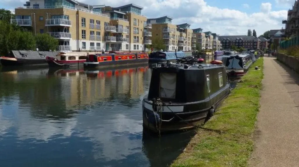
Canal towpaths are routes beside waterways that originally allowed horses and other working animals to pull boats carrying goods. In West London, these paths follow sections of the Grand Union Canal and connect historic waterways with neighbourhoods, parks and transport links.
A towpath traditionally ran along the bank of a canal or navigable river. Horses walked along the path while pulling boats through a rope attached to the vessel. This arrangement allowed boats to move cargo before powered canal boats became widespread.
The Grand Union Canal provides the main focus for canal towpath exploration in West London. Its London sections pass through areas shaped by industrial development, housing expansion and improvements to transport infrastructure.
Modern towpaths serve several purposes. Walkers use them for leisure and exercise. Cyclists use permitted sections for local journeys. Runners follow waterside routes for outdoor fitness. Residents also use canal corridors to reach nearby parks, railway stations and neighbourhood facilities.
Towpaths differ from ordinary pavements because they form part of a working waterway environment. Boats continue to use the canal, and the path shares space with lock operations, mooring areas and maintenance activities.
Visitors should recognise that not every towpath has the same surface, width or accessibility. Some sections have firm, level paths, while others feature uneven surfaces, narrow bridges, steps or limited lighting.
Which Canals and Towpaths Can Visitors Explore in West London?
The Grand Union Canal is the principal canal for towpath walks in West London. Its routes include stretches around Brentford, Hanwell, Southall and Hayes, with connections to historic locks, local parks, residential districts and the wider London canal network.
The Grand Union Canal offers a connected waterway landscape rather than one isolated walking route. Visitors can choose a short neighbourhood walk or combine several sections into a longer journey.
Grand Union Canal through Brentford
Brentford provides an important meeting point between the Grand Union Canal and the River Thames. The surrounding area contains a mixture of historic waterways, residential development, commercial buildings and modern regeneration projects.
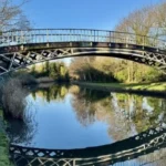
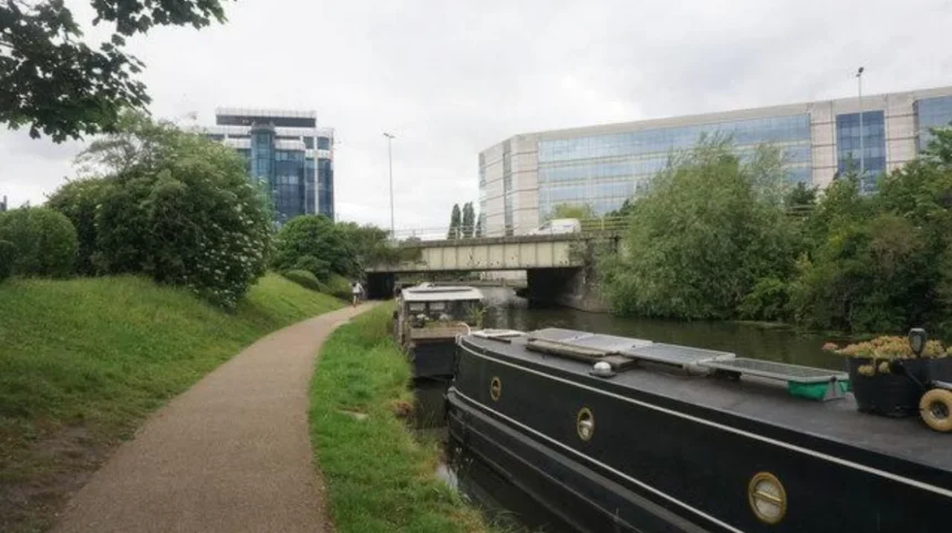
Towpath walks around Brentford reveal the relationship between canal transport and London’s riverside economy. Visitors encounter moored boats, bridges and waterside infrastructure that reflect the area’s long connection with trade and navigation.
Brentford also provides opportunities to connect a canal walk with nearby public spaces and Thames-side routes. Route planning should account for towpath closures, local construction and changes in pedestrian access.
Grand Union Canal through Hanwell
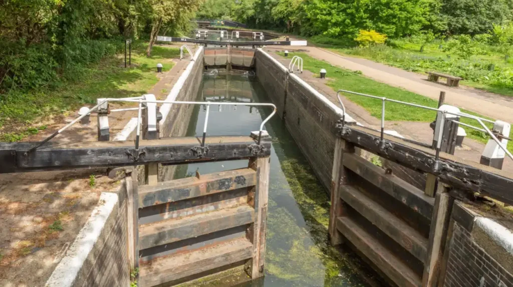
Hanwell is particularly associated with the canal’s historic locks. The Hanwell Flight forms a sequence of locks that raises or lowers boats through changes in ground elevation.
The area offers an opportunity to observe how canal engineers managed water levels and boat movements. Walking beside the locks reveals gates, chambers, lockside structures and changes in the canal’s elevation.
Hanwell’s canal corridor also connects with local green spaces. Visitors interested in industrial history, engineering and outdoor recreation find several subjects to explore along this stretch.
Grand Union Canal through Southall
The canal through Southall passes through an area known for its cultural diversity, residential neighbourhoods and historic transport connections.
Towpath walks here provide a different experience from the more rural-looking sections of the waterway. The route illustrates how a historic canal remains integrated into a densely populated urban environment.
Visitors should identify suitable access points before starting. Street connections, bridges and local facilities help determine the most convenient starting and finishing locations.
Grand Union Canal through Hayes
Hayes has a strong industrial history associated with manufacturing, transport and commercial development. The canal played a role in moving materials and finished products during periods when water transport was central to Britain’s industrial economy.
The towpath offers a way to explore this relationship between waterways and employment. Buildings, bridges and industrial landscapes near the canal help explain how transport infrastructure influenced the growth of West London.
Conditions vary between sections. Visitors should check the intended route and available exits before setting out on a longer walk.
How Did West London’s Canal Towpaths Develop Historically?
West London’s canal towpaths developed during the expansion of Britain’s canal network in the late eighteenth and nineteenth centuries. The Grand Junction Canal, opened in 1805, improved water transport between London and the Midlands and contributed to the region’s industrial growth.
Canal construction transformed the movement of goods across Britain. Before extensive railway networks developed, waterways provided an important method of transporting heavy materials, agricultural produce and manufactured products.
The Grand Junction Canal was authorised in 1793 and opened in 1805. It connected the London area with the canal network leading towards the Midlands. The route later became part of the Grand Union Canal system.
West London’s growing population and industrial economy benefited from improved access to water transport. Factories, warehouses, wharves and other businesses developed near navigable waterways because canals reduced the cost and difficulty of moving bulky goods over land.
Why were towpaths essential to canal transport?
Towpaths provided the route for horses to pull boats when wind power or onboard propulsion was unsuitable. A horse walking along the bank could move a heavily loaded narrowboat through a canal.
Canal engineers designed towpaths alongside the waterway, although local geography sometimes required changes in alignment. Bridges, lock approaches and other structures helped maintain the route where roads or waterways intersected.
The introduction of steam power and other forms of mechanical propulsion gradually reduced the need for horse towing. However, the physical towpaths remained part of the canal landscape.
How did railways change canal use?
Railway expansion created competition for canal transport during the nineteenth century. Trains offered faster connections for passengers and many types of freight, while canals retained advantages for some heavy and bulky cargoes.
Canal companies adapted to changing commercial conditions through consolidation, investment and operational changes. The Grand Junction Canal eventually became part of the wider Grand Union Canal network.
Commercial canal traffic declined in many locations during the twentieth century as road haulage and modern logistics developed. Recreational boating and waterside leisure subsequently became increasingly important uses of the waterways.
Why does canal history remain visible today?
Historic locks, bridges, towpaths and surviving industrial structures preserve evidence of Britain’s transport history. These features explain how engineers moved boats through changing elevations and connected cities with inland markets.
The Canal & River Trust, which cares for much of the UK’s canal and river network in England and Wales, maintains waterways and supports public access. Its work helps preserve historic structures while accommodating navigation, recreation and environmental management.
Visitors should treat locks and other canal infrastructure as operational structures rather than simply decorative features. Boaters, maintenance staff and waterway users continue to rely on them.
What Are the Best Canal Towpath Walks in West London?
The best canal towpath walks in West London include the Hanwell Lock Flight, Brentford’s canal and Thames connections, and the Grand Union Canal through Southall and Hayes. Each route offers different combinations of industrial heritage, waterside scenery, wildlife and urban history.
The most suitable route depends on available time, walking ability, transport connections and interest in local landmarks. Short walks near locks suit visitors interested in engineering, while longer linear walks provide a broader view of West London’s waterways.
Hanwell Lock Flight walking route
The Hanwell Lock Flight is one of the area’s most distinctive canal destinations. The Canal & River Trust identifies a flight of seven locks on this section of the Grand Union Canal. The locks manage changes in water level as boats travel along the canal.
Visitors can walk along the towpath, observe boats using the locks and examine historic canal features. The surrounding landscape offers a green corridor within London’s urban environment.
The Canal & River Trust lists Green Lane, Hanwell, W7 2PJ, as an access location. Hanwell railway station is approximately a 15-minute walk away, according to its visitor information. The Trust also notes that parking is limited and there are no toilets at the site.
This route suits visitors who want to explore a historic waterway without committing to a long-distance walk.
Brentford canal and riverside walk
Brentford offers opportunities to explore the relationship between the Grand Union Canal and the River Thames. The canal’s connection with the Thames helped establish the waterway as a transport route between London and the Midlands.
Visitors can examine waterside buildings, moored boats and bridges while observing the transition between canal and river environments. The surrounding neighbourhood also provides connections to public spaces and local streets.
Before visiting, check access arrangements around the intended starting point. Development projects and temporary restrictions sometimes affect pedestrian routes in urban areas.
Southall and Hayes canal walk
The canal corridor between Southall and Hayes provides an opportunity to explore West London’s industrial and residential landscapes.
Visitors encounter a mixture of urban infrastructure, bridges, waterside vegetation and local access points. These features illustrate how the canal remains integrated into the everyday geography of West London.
A linear walk requires advance planning because the return journey can involve retracing the towpath or using public transport. Check station locations, walking distances and current service information before departure.
How should visitors choose a route?
Select a route based on its distance, surface, accessibility and available facilities. A short visit to Hanwell’s locks suits a focused heritage walk. Brentford suits visitors combining canal exploration with a riverside visit. Southall and Hayes suit people interested in urban history and local transport connections.
Always check the current towpath conditions before travelling. Canal access points and walking conditions vary between locations.
How Do Canal Locks Work Along West London’s Towpaths?
Canal locks move boats between sections of water at different heights. A lock chamber uses gates and controlled water flow to raise or lower a boat. West London’s Hanwell Lock Flight demonstrates this engineering system along the Grand Union Canal.
A canal cannot always follow a completely level route. Changes in terrain require engineers to manage the difference in elevation between sections of water.
A lock solves this problem through a chamber fitted with gates at each end. Water enters or leaves the chamber to adjust its level to the adjoining canal section.
What happens when a boat travels through a lock?
When a boat approaches a lock, the gates and water level determine whether it can enter safely. The operator opens the appropriate gates after the water level in the chamber matches the level on the boat’s side.
Once the boat enters, the gates close. Water then enters or leaves the chamber through controlled paddles or sluices until the chamber reaches the level of the next section.
The gates on the destination side can then open, allowing the boat to continue.
This process allows boats to travel through changes in elevation without requiring a continuous, level canal.
Why is Hanwell’s lock flight historically important?
Hanwell’s locks demonstrate how canal engineering enabled boats to travel through London’s varied landscape. The site includes historic structures associated with the operation and maintenance of the waterway.
The Canal & River Trust identifies the Hanwell Lock Flight as a historic feature of the Grand Union Canal. Its visitor information highlights lockside cottages and a ramp designed to help horses escape from the canal if they fell into the water.
These features reveal the practical challenges of operating a horse-drawn canal system. They also help visitors understand the human and animal labour behind Britain’s historic transport network.
What should walkers know near canal locks?
Lock areas require additional care because boats, gates and moving water create operational hazards. Visitors should keep clear of moving gates, operating equipment and boat-handling areas.
Children should remain under close adult supervision. Dogs should be kept under control near the water’s edge.
Walkers should also allow boaters enough room to operate the lock. These areas often attract visitors who stop to observe the process, so maintaining a clear route helps everyone use the towpath safely.
What Wildlife Can Visitors See Along West London’s Canal Towpaths?
West London’s canal towpaths support urban wildlife through connected strips of waterside vegetation, trees, aquatic habitats and sheltered banks. Visitors can observe birds, insects and other animals along the Grand Union Canal, although sightings vary with season, weather, habitat conditions and human activity.
Canal corridors provide habitat within densely developed parts of London. Vegetated banks, overhanging trees and quieter stretches of water support different species and create connections between green spaces.
Wildlife observation adds an environmental dimension to canal walking. Visitors can examine how waterways function as both transport infrastructure and living ecosystems.
Which birds live around canal waterways?
Canal environments provide feeding and resting opportunities for water-associated birds and species that use trees and scrub.
Depending on location and season, visitors can look for mallards, coots, moorhens and other familiar urban birds. Kingfishers occur along suitable waterways, although a sighting is never guaranteed.
Birds use the canal for different purposes. Some feed in the water, others search the banks for food, and some nest in nearby vegetation.
Visitors should observe birds without approaching nests or disturbing feeding animals. Feeding bread to waterfowl is unnecessary and can contribute to poor water quality and unhealthy feeding patterns.
How do canal banks support insects and plants?
Waterside vegetation provides food and shelter for insects. Flowering plants attract pollinators, while trees and shrubs provide habitats for invertebrates and birds.
The ecological value of a canal depends partly on the condition of its banks. Vegetation management, water quality, shading and nearby land use influence the species that thrive along the route.
Some canal sections have more natural vegetation than others. Heavily urbanised stretches can still provide habitat, but their ecological character differs from less developed waterways.
Why are canal towpaths important for urban biodiversity?
Urban biodiversity refers to the variety of living organisms and habitats within towns and cities. Canals contribute to this diversity by creating elongated habitat corridors through built-up neighbourhoods.
These corridors connect places where wildlife feeds, rests and reproduces. Their value increases when vegetation and green spaces remain connected across the wider landscape.
However, towpath use also creates environmental pressures. Litter, uncontrolled dogs, disturbance and poorly managed vegetation affect wildlife and habitat quality.
Visitors can help protect these environments by taking rubbish home, keeping dogs under control and avoiding damage to plants and banks.
Are West London’s Canal Towpaths Suitable for Walking, Cycling and Running?
Many West London canal towpaths support walking, cycling and running, but users share narrow spaces beside the water. Pedestrians require priority, while cyclists and runners need to slow down, remain alert and give other users enough room to pass safely.
Towpaths were originally designed for horses pulling boats, not for modern traffic volumes. Their narrow dimensions create challenges when walkers, cyclists, runners, anglers and boaters use the same space.
The Canal & River Trust encourages considerate behaviour through its Towpath Code. It asks faster users to take particular care around pedestrians, pets, wildlife and people handling boats.
Can visitors cycle along canal towpaths?
Cycling is permitted on many Canal & River Trust towpaths, and a general permit is not required on its towpath network. However, local restrictions and temporary closures apply, and not every towpath section is suitable for cycling.
Cyclists should ride slowly, especially near bridges, bends, lock approaches and crowded areas. A bell provides a useful warning when approaching people from behind, although it does not replace the need to reduce speed.
Cyclists should also dismount where signs request it. Narrow paths and poor visibility sometimes make walking with a bicycle the safest option.
Can runners use canal towpaths?
Running is possible along many towpath sections, particularly during quieter periods. However, runners should avoid treating shared towpaths as race tracks.
Approach other users carefully, leave room when passing and avoid sudden movements near the water’s edge. Busy sections are better suited to relaxed running than high-speed training.
Long-distance runners should plan their routes around access points, lighting conditions and the availability of alternative paths.
Are towpaths suitable for wheelchairs and mobility aids?
Accessibility varies by location. Some towpaths have firm, relatively level surfaces, while others feature uneven ground, narrow passages, steps or barriers.
The Canal & River Trust welcomes wheelchair users and people using mobility aids on its towpaths, while advising everyone to take care. Actual suitability depends on the individual section and the user’s access requirements.
Visitors who need step-free access should check the precise entry point, surface conditions, bridge arrangements and any temporary restrictions before travelling.
Are electric scooters allowed on towpaths?
The Canal & River Trust states that e-scooters are not permitted on its towpaths under its current guidance. Its rules distinguish prohibited motorised vehicles from compliant electrically assisted pedal cycles.
Visitors should check the latest guidance before travelling, particularly if using an unfamiliar type of vehicle.
How Can Visitors Plan a Safe Canal Towpath Walk in West London?
A safe canal walk starts with checking the route, weather, access points and current towpath notices. Visitors should wear suitable footwear, keep away from the water’s edge, supervise children, control dogs and respect boat operations throughout the journey.
Preparation is particularly important when walking unfamiliar sections of the Grand Union Canal. Conditions change with rainfall, seasonal vegetation growth, maintenance work and construction near urban access points.
What should visitors bring?
For a short walk, suitable footwear, drinking water and a charged mobile phone are generally useful. Longer journeys require additional preparation, including weather-appropriate clothing and a clear plan for returning to the starting point.
A map or navigation application helps identify bridges, roads and transport connections. Visitors should not rely entirely on mobile coverage or assume every towpath section has convenient exits.
People planning longer walks should also check daylight hours, particularly during autumn and winter.
What safety risks should walkers understand?
The main risks include slipping on wet surfaces, encountering cyclists in narrow sections, walking close to deep water and entering areas where boats or locks are operating.
Canal banks do not always have protective barriers. Wet leaves, mud and uneven paving increase the risk of falls, especially after rain.
Walkers should keep a safe distance from the water’s edge and avoid climbing onto lock structures or moored boats. Children need continuous supervision around open water.
How should visitors behave around other users?
The Canal & River Trust promotes considerate behaviour because towpaths serve different groups simultaneously. Pedestrians need space to walk, cyclists need to control their speed, and boaters need room to handle vessels safely.
Visitors should keep to a sensible walking line, avoid blocking narrow bridges and allow others to pass where the path widens.
Dog owners should keep animals under control and clear up after them. Everyone should take litter home to protect wildlife and maintain a clean environment.
What should visitors do during a towpath closure?
Towpath closures sometimes occur because of maintenance, construction, structural repairs or safety concerns. The Canal & River Trust publishes notices about closures and waterway restrictions.
Check the official notices before travelling. Follow signed diversions rather than entering a closed section or crossing maintenance barriers.
For longer walks, identify an alternative route before departure. A closure can affect access to bridges, stations and the planned finishing point.
How Can Visitors Reach West London’s Canal Towpaths by Public Transport?
West London’s canal towpaths are accessible from several urban neighbourhoods served by rail, Underground and bus connections. Hanwell provides a useful example, with the Canal & River Trust listing a railway station approximately 15 minutes on foot from the Hanwell Lock Flight.
Public transport reduces the need to find parking and supports one-way walking routes. However, the most convenient station depends on the exact section of canal being visited.
How can visitors reach Hanwell’s towpath?
The Hanwell Lock Flight has an access point on Green Lane, Hanwell, W7 2PJ. The Canal & River Trust identifies Hanwell railway station as approximately a 15-minute walk away. It also lists bus route B3 as serving the area near the other end of Green Lane.
Visitors should check current railway and bus services before departure. Walking time varies with the chosen station exit, access point and individual walking pace.
The Trust also reports limited on-street parking at this location. Visitors planning to drive should check local parking restrictions and avoid blocking residential access.
How should visitors plan a one-way canal walk?
A one-way route allows visitors to explore a longer section without returning along the same path. To plan one, identify the starting point, finishing point and nearest suitable transport connections.
Check the distance between access points rather than estimating the route from a map’s straight-line measurement. Canals follow their own alignment, so walking distances differ from direct distances between neighbourhoods.
Allow additional time for lock observations, photographs, rest stops and unexpected diversions.
Where can visitors find official route information?
The Canal & River Trust provides waterway information, walking suggestions and route-planning resources through its official website. Its Grand Union Canal page identifies destinations and notable locations along the network.
Local council websites provide information about nearby parks, public transport connections and local access arrangements. Current transport operators’ websites provide service updates and journey-planning information.
Using these sources together helps visitors confirm the route before setting out.
Are West London’s Canal Towpaths Suitable for Families?
West London’s canal towpaths provide opportunities for family walks, wildlife observation and learning about transport history. Families should choose accessible sections, supervise children near the water, avoid busy cycling areas where possible and check the availability of toilets and other facilities beforehand.
Canal walks offer practical ways for children to learn about local history and the natural environment. Watching boats pass through locks introduces basic engineering concepts, while observing birds and plants encourages outdoor learning.
The best family route depends on children’s ages, walking ability and access requirements.
What can children learn during a canal visit?
Canal towpaths offer examples of how people engineered transport systems before modern roads and motorways dominated freight movement.
Children can observe how locks raise and lower boats, identify bridges and compare historic canal structures with modern infrastructure. Wildlife observation also introduces topics such as habitats, food sources and the importance of clean water.
Adults should explain that canals are working waterways. Lock gates, water edges and moored boats require particular care.
What facilities should families check?
Facilities differ between canal access points. Some locations have nearby cafés, shops or public toilets, while others offer few amenities.
The Canal & River Trust’s visitor information for Hanwell Lock Flight states that there are no toilets at the site and that parking is limited.
Families should plan toilet stops, food breaks and transport connections before leaving home. This preparation is especially important for younger children and visitors with mobility requirements.
Are canal towpaths suitable for pushchairs?
Some towpath sections have surfaces suitable for pushchairs, while others are uneven, muddy or restricted by narrow bridges and steps.
Check the planned route rather than assuming that every section is accessible. A short walk from a suitable access point is often more practical than a long journey through unfamiliar terrain.
Families should also avoid stopping where pushchairs block the path, particularly near bridges and lock approaches.
How Do Canal Towpaths Contribute to West London’s Environment and Communities?
Canal towpaths contribute to West London by providing recreational routes, supporting active travel and connecting green spaces within built-up neighbourhoods. Their wider value depends on responsible public use, habitat protection, waterway maintenance and continued access to suitable walking and cycling routes.
Canals form part of the region’s historic infrastructure, but their role extends beyond navigation. Towpaths support everyday recreation, environmental awareness and connections between residential areas.
How do towpaths support active travel?
Active travel means making journeys through physical activity, particularly walking and cycling. Canal towpaths provide alternatives to some road-based journeys where the route connects useful destinations and cycling is permitted.
Their value depends on continuity, surface quality, safe access points and connections to local streets. A towpath is not automatically a practical transport route simply because it runs through a neighbourhood.
Visitors should also remember that towpaths are shared spaces. Their recreational and transport functions require considerate use rather than speed-focused travel.
How do towpaths connect urban green spaces?
A canal corridor creates a linear strip of open space through the surrounding built environment. Trees, waterside vegetation and nearby parks help link habitats across urban areas.
These connections support movement through the landscape for some wildlife species. Their effectiveness depends on vegetation quality, barriers, surrounding development and the availability of suitable habitats.
Protecting canal banks and managing vegetation responsibly helps preserve the environmental value of these corridors.
Why is canal heritage important to local communities?
Historic waterways help explain the development of West London’s industries, settlements and transport connections.
The Grand Union Canal’s history connects local places with the wider story of Britain’s industrial development. Structures such as Hanwell’s locks provide visible evidence of the engineering systems that once supported commercial transport.
Canal heritage also supports informal learning and local recreation. Residents and visitors can explore historical infrastructure without needing to enter a museum or heritage building.
What challenges affect canal towpaths?
Shared use creates pressure on narrow paths, especially during busy periods. Poorly managed litter, damaged surfaces, vegetation growth and conflicts between faster and slower users also affect the visitor experience.
Maintenance requires coordination between waterway managers, local authorities and other organisations responsible for adjacent land and infrastructure.
Responsible public behaviour remains essential. Visitors who respect access restrictions, protect wildlife and use the towpath considerately help preserve the canal environment for future users.
Explore More Area Guide
Thames Path in West London: Routes, History and Attractions
West London Waterfront Attractions: Canals, Parks and Riverside Walks
What Is the Future of Canal Towpaths in West London?
The future of West London’s canal towpaths depends on maintaining historic waterways while improving safe access, supporting biodiversity and accommodating growing recreational use. Regular maintenance, responsible cycling, habitat protection and clear route information remain important for keeping these corridors useful to local communities.
Canal towpaths face the challenge of serving different needs within a limited amount of space. Walking, cycling, boating, wildlife conservation and heritage protection all influence how these routes are managed.
How will maintenance influence towpath access?
Regular maintenance helps keep paths usable and protects canal infrastructure. Work includes managing vegetation, repairing surfaces, inspecting structures and maintaining locks and banks.
Some maintenance activities require temporary closures. Clear notices and suitable diversions help visitors plan journeys around these restrictions.
The Canal & River Trust maintains a substantial network of waterways in England and Wales. Its work supports navigation, public access and the conservation of historic canal infrastructure. Visitors should consult its current notices when planning a walk.
Why will environmental protection remain important?
Canal towpaths occupy narrow but potentially valuable green corridors within urban areas. Protecting vegetation, limiting litter and reducing disturbance helps maintain their ecological function.
Environmental management also requires balancing public access with wildlife needs. Some sections benefit from natural vegetation, while others need carefully managed surfaces and clear passage for visitors.
Responsible behaviour supports this balance. Keeping dogs under control, avoiding damage to banks and taking rubbish home help protect the canal environment.
How can communities benefit from improved towpaths?
Well-maintained towpaths provide accessible opportunities for outdoor recreation and local exploration. Where suitable connections exist, they also support walking and cycling between neighbourhoods.
Improvements are most effective when they address actual local needs, including surface conditions, safe access points, signage and connections to public transport.
West London’s canal corridors therefore remain relevant as both historic infrastructure and contemporary public spaces. Their future value depends on maintaining the character of the waterways while making access safe and practical.
How Can Visitors Make the Most of Canal Towpaths in West London?
Visitors can make the most of West London’s canal towpaths by selecting a suitable route, checking current access information and allowing time to explore locks, bridges, wildlife and historic surroundings. Hanwell, Brentford, Southall and Hayes provide useful starting points for different canal experiences.
A successful canal visit begins with choosing a route that matches the available time and walking ability. Visitors interested in engineering history can focus on Hanwell’s locks, while those seeking a wider urban exploration can consider Brentford and other sections of the Grand Union Canal.
Before setting out, check current transport services, path closures, weather conditions and access requirements. Carry water, wear suitable footwear and plan a return journey for longer walks.
During the visit, respect the waterway as an operational environment. Give pedestrians priority when cycling, remain alert near locks, keep children away from the water’s edge and avoid disturbing wildlife.
Canal towpaths connect West London’s industrial past with its modern neighbourhoods and green spaces. Exploring them offers a practical way to understand the area’s history, observe urban wildlife and enjoy waterside recreation.
Their continued value depends on responsible use and effective maintenance. With suitable planning, visitors can explore these historic routes while helping protect them for future generations.
Where can you find canal towpaths in West London?
West London canal towpaths follow sections of the Grand Union Canal through areas including Brentford, Hanwell, Southall and Hayes. These routes offer waterside walks, historic canal structures and opportunities to observe local wildlife.