

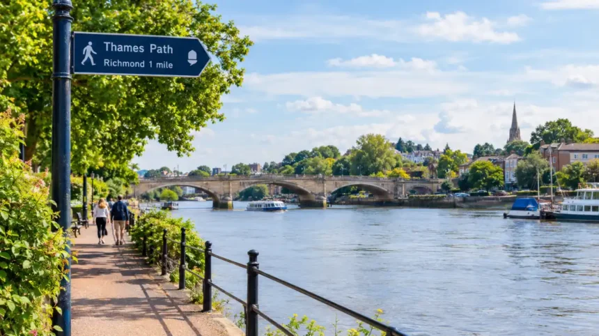
The Thames Path in West London is a long-distance walking route that follows the River Thames through historic riverside neighbourhoods, green spaces, bridges and waterfront landmarks. It provides access to riverside scenery, heritage sites and public walking routes across areas including uk/local/richmond-upon-thames/richmond/">Richmond, Twickenham, hounslow/brentford/">Brentford, Chiswick and fulham/hammersmith/">Hammersmith.
- What Is the Thames Path in West London?
- Where Does the Thames Path Run Through West London?
- What Is the Historical Importance of the Thames Path in West London?
- How Did the River Thames Shape West London?
- Which Historic Bridges Can Walkers See?
- How Did Riverside Recreation Develop?
- Which Thames Path Walks Are Best for Exploring West London?
- What Can Walkers See Between Richmond and Twickenham?
- What Makes the Kew and Chiswick Section Distinctive?
- Why Choose Barnes and Hammersmith for a Riverside Walk?
- Which Parks and Nature Reserves Are Accessible From the Thames Path?
- What Is the Role of Petersham Meadows?
- Why Visit Old Deer Park?
- What Can Visitors Learn at the London Wetland Centre?
- How Does Kew Add to the Riverside Experience?
- How Can Visitors Reach the Thames Path in West London?
- Which Stations Provide Access to the River?
- Is the Thames Path Suitable for a Day Trip?
- Should Visitors Use a Car?
- Is the Thames Path in West London Accessible to Everyone?
- Can Wheelchair Users and Families With Pushchairs Use the Route?
- Are Dogs Allowed on the Thames Path?
- What Safety Precautions Should Walkers Follow?
- How Does the Thames Path Support West London’s Communities and Environment?
- How Does the Route Benefit Local Businesses?
- Why Is River Conservation Important?
- How Does the Thames Path Fit Into Sustainable Travel?
- How Should Visitors Plan a Thames Path Walk in West London?
- Why Is the Thames Path an Important West London Walking Destination?
The route forms part of the wider Thames Path National Trail, which follows the River Thames from its source in Gloucestershire to the Thames Barrier in Greater London. West London’s sections combine historic settlements, landscaped riverside paths, former industrial areas and open spaces used by walkers, runners and cyclists where access permits.
What Is the Thames Path in West London?
The Thames Path in West London is part of a long-distance walking trail beside the River Thames. It connects riverside communities, historic buildings, parks and bridges, providing access to the capital’s waterways, heritage and outdoor spaces.
The Thames Path National Trail is a waymarked route managed through cooperation between the relevant public authorities and land managers. Natural England oversees the National Trail designation, while local councils and other organisations manage individual sections and facilities.
The trail follows the Thames through different landscapes. In West London, walkers encounter residential riverfronts, public parks, historic wharves, boat facilities and bridges linking neighbourhoods on opposite banks. The surroundings change from one section to another, reflecting the river’s long-standing role in settlement, trade, recreation and transport.
The Thames Path is not a single uninterrupted pavement. Some sections follow paved promenades, while others pass along compacted paths, public rights of way and riverside streets. Local diversions, construction works, tides and river conditions affect access in particular locations.
For visitors, the route offers opportunities to explore West London at walking pace. Residents use accessible sections for daily exercise, dog walking and short riverside outings. Longer-distance walkers follow connected sections as part of a wider journey along the Thames.
Where Does the Thames Path Run Through West London?
The Thames Path passes through West London riverside areas including Richmond, Twickenham, Brentford, Chiswick and Hammersmith. Its exact route follows the river through connected paths, public spaces, bridges and streets, with local access conditions varying between individual sections.
West London contains several distinct stretches of the Thames Path. Each provides a different combination of scenery, transport connections, historic buildings and recreational facilities.
Richmond upon Thames
Richmond is one of the best-known riverside destinations in West London. Its waterfront includes a broad pedestrian area, historic buildings, restaurants and views across the Thames. Richmond Bridge, completed in 1777, is a significant historic crossing and a prominent feature of the riverside landscape.
Richmond Riverside connects the town centre with waterside walking routes. Richmond Green and nearby historic streets provide additional places to explore away from the river. Richmond station offers Underground, Overground and National Rail connections, making the area convenient for visitors travelling without a car.
Twickenham and Strawberry Hill
Twickenham occupies a riverside position in the London Borough of Richmond upon Thames. The area combines residential streets, historic buildings, boat activity and green spaces.
Eel Pie Island is a notable feature of the local river landscape. Access to the island is restricted, so walkers should follow public access arrangements rather than assume that every riverside location is open to visitors.
Strawberry Hill and the wider Twickenham area provide opportunities to combine riverside walking with visits to historic architecture and local parks. The route between Twickenham and Richmond also offers views of river bends, bridges and established riverside properties.
Brentford and Kew
Brentford lies near the confluence of the River Brent and the River Thames. Its waterways reflect the area’s industrial and transport history. The Grand Union Canal also reaches the Thames at Brentford, creating an important connection between inland navigation and the tidal river.
Nearby Kew provides access to the Royal Botanic Gardens, Kew, a UNESCO World Heritage Site recognised for its botanical collections, historic landscape and scientific importance. The gardens are a separate visitor attraction with their own admission arrangements and opening hours.
Chiswick and Hammersmith
Chiswick contains riverside green spaces, historic houses and residential waterfronts. Chiswick Mall is known for its historic riverside buildings, while nearby Strand-on-the-Green offers a distinctive stretch of waterfront with historic pubs and views across the Thames.
Further east, Hammersmith Bridge connects Hammersmith with Barnes. The surrounding riverbanks provide views of the bridge, rowing activity and riverside buildings. Walkers should check current bridge access arrangements before planning a route that depends on crossing it.
These locations illustrate the geographical range of the Thames Path in West London, from historic market towns and canal junctions to residential waterfronts and major urban landmarks.
What Is the Historical Importance of the Thames Path in West London?
The Thames Path follows a river that shaped West London’s settlement, trade, transport and recreation. Historic bridges, riverside houses, former industrial sites and navigation infrastructure show how communities developed around the Thames over several centuries.
The River Thames has influenced London’s growth since the Roman period. Its waterway supported trade, movement and communication, while riverside settlements developed around crossings, landing places and commercial activities.
West London’s history remains visible along the river. Richmond grew as a settlement associated with royal connections and riverside residences. Twickenham developed a distinctive architectural heritage, while Brentford became an important location for water transport and industry.
How Did the River Thames Shape West London?
The Thames provided a transport corridor before modern roads and railways expanded across London. Boats moved goods and passengers between riverside settlements and commercial centres. The river also supported fishing, boatbuilding and other activities connected with navigation.
Brentford’s location at the mouth of the River Brent and the western end of the Grand Union Canal made it an important transport junction. The canal connected the Thames with inland waterways and industrial communities. Historic wharves and surviving waterfront features reflect this commercial past.
Which Historic Bridges Can Walkers See?
Richmond Bridge, Kew Bridge, Chiswick Bridge and Hammersmith Bridge are among the recognisable crossings associated with the West London river corridor. Each bridge reflects a different period of engineering and urban development.
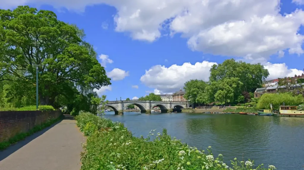
Richmond Bridge opened in 1777 and is the oldest surviving bridge across the Thames in Greater London. Its stone construction and curved arches make it a significant historic landmark.
Hammersmith Bridge, originally opened in 1827 and reconstructed in 1887, is an important suspension bridge. Its condition and access arrangements have been subject to restrictions, so visitors should check official updates before planning a crossing.
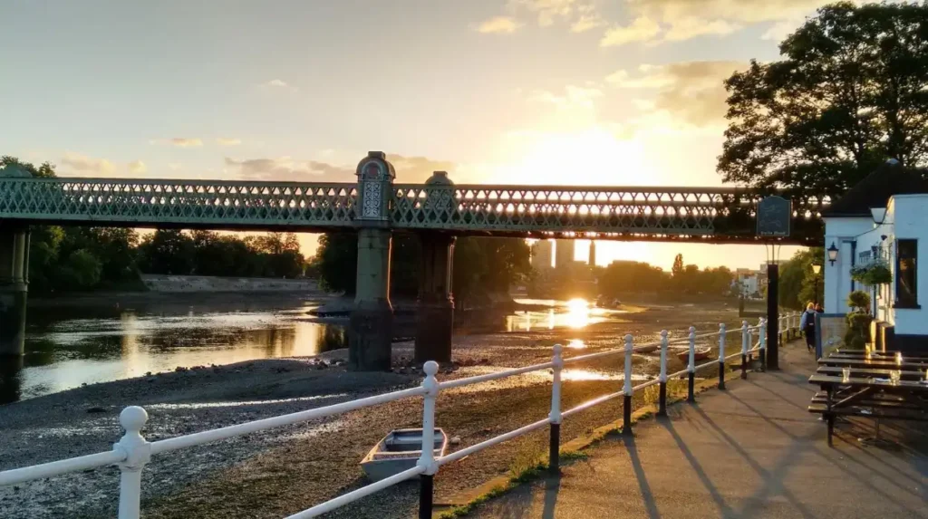
Kew Bridge connects the Kew and Brentford areas. Chiswick Bridge, opened in 1933, forms part of the wider road network and provides a recognisable landmark near riverside walking routes.
How Did Riverside Recreation Develop?
The Thames gradually became an important recreational destination as London expanded. Riverside promenades, public gardens, rowing clubs and leisure facilities created opportunities for residents to enjoy the water away from commercial activity.
Today, the Thames Path continues this recreational tradition. Walking the route provides direct access to historic waterfronts while connecting neighbourhoods with parks, nature reserves and public transport.
Which Thames Path Walks Are Best for Exploring West London?
The best Thames Path walks in West London depend on the preferred distance, scenery and transport connections. Popular choices include Richmond to Twickenham, Kew to Chiswick, Barnes to Hammersmith and the riverside stretch between Richmond and Hampton Court.
West London offers both short riverside outings and longer linear walks. The appropriate route depends on walking pace, riverbank access, available daylight and the locations chosen for the start and finish.
The following examples provide practical starting points rather than fixed itineraries. Actual distances depend on the selected bank, diversions and the precise start and finish points.
What Can Walkers See Between Richmond and Twickenham?
The Richmond–Twickenham area combines historic bridges, riverside buildings, landscaped spaces and residential waterfronts. Walkers can explore Richmond Riverside before continuing towards Twickenham, subject to the chosen route and access conditions.
Richmond’s historic town centre provides shops, cafés and public transport. The surrounding riverside includes views of the Thames and access to green spaces. Approaching Twickenham introduces additional historic buildings and views across the water.
This section suits visitors interested in combining a walk with local architecture, refreshments and transport connections. Check the route map before setting out because crossing to the opposite bank changes the walking distance and available landmarks.
What Makes the Kew and Chiswick Section Distinctive?
The Kew–Chiswick stretch connects riverside neighbourhoods with historic buildings, gardens and waterside pubs. Walkers encounter changing views of the river, established residential areas and locations associated with London’s botanical and architectural heritage.
The Royal Botanic Gardens, Kew, is a major attraction near the river. Its collections and historic landscape are recognised through UNESCO World Heritage status. Visiting the gardens requires separate planning because opening times and admission arrangements differ from those of the public walking path.
Chiswick provides access to Strand-on-the-Green and Chiswick Mall. These areas contain historic riverside buildings and views across the Thames. The route is suitable for a shorter walk combined with local sightseeing, provided the selected path is open.
Why Choose Barnes and Hammersmith for a Riverside Walk?
Barnes and Hammersmith offer views of the Thames, historic bridges and areas associated with rowing and riverside recreation. The contrast between quieter residential waterfronts and busier urban locations makes this part of the river corridor geographically varied.
Barnes is also close to the London Wetland Centre, an urban wetland reserve operated by the Wildfowl and Wetlands Trust. The centre provides managed habitats for wetland wildlife and a separate visitor experience.
Hammersmith provides transport connections, riverside paths and views of Hammersmith Bridge. Visitors should confirm current crossing restrictions and use a verified walking map when planning a circular route.
Which Parks and Nature Reserves Are Accessible From the Thames Path?
The Thames Path connects with several important green spaces and wildlife destinations in West London, including Petersham Meadows, Old Deer Park, the Royal Botanic Gardens, Kew, and the London Wetland Centre near Barnes. Access and admission rules differ between sites.
The river corridor contains a mixture of public parks, managed gardens, natural habitats and developed waterfronts. These environments support recreation while providing important spaces for plants, birds and other wildlife.
What Is the Role of Petersham Meadows?
Petersham Meadows is an open riverside landscape near Richmond. Its grassland, river views and relatively open setting provide a contrast with the built-up town centre.
The meadows contribute to the distinctive landscape between Richmond and Twickenham. Visitors should remain on permitted paths, respect land-management notices and avoid disturbing grazing animals where present.
Why Visit Old Deer Park?
Old Deer Park is a large green space near Richmond town centre. Its historic associations and open landscape make it a useful destination for walking and outdoor recreation.
The park lies close to the Thames corridor and provides opportunities to extend a riverside outing. Its combination of open ground and mature trees also contributes to the area’s urban green infrastructure.
What Can Visitors Learn at the London Wetland Centre?
The London Wetland Centre in Barnes is a wildlife reserve managed by the Wildfowl and Wetlands Trust. It contains wetland habitats designed to support wildlife and provide opportunities for nature observation and environmental education.
Visitors can learn about wetland ecosystems, migratory birds and habitat conservation. The centre is a managed attraction with its own admission arrangements, rather than an unrestricted section of the Thames Path.
How Does Kew Add to the Riverside Experience?
The Royal Botanic Gardens, Kew, combines botanical research, plant collections and historic landscapes. Its scientific and conservation work gives the area significance beyond its role as a recreational destination.
The gardens are close to the Thames and can be included in a wider West London visit. Walkers should distinguish between the public riverside route and the gardens’ ticketed grounds.
How Can Visitors Reach the Thames Path in West London?
Public transport is one of the most practical ways to reach the Thames Path in West London. Richmond, Kew, Chiswick, Barnes and Hammersmith have transport connections, allowing walkers to choose linear routes without returning to their starting point.
West London’s rail, Underground and bus networks provide access to many riverside neighbourhoods. A linear walk is often easier to organise when the starting and finishing locations have suitable transport connections.
Which Stations Provide Access to the River?
Richmond station serves the town centre and connects with the District line, London Overground and National Rail services. Kew Gardens station provides Underground and Overground connections near the botanical gardens. Barnes and Barnes Bridge stations provide access to parts of the riverside corridor, while Hammersmith has Underground connections.
The distance between each station and the river varies. Check the walking approach before travelling, particularly when planning a route with limited time or mobility requirements.
Is the Thames Path Suitable for a Day Trip?
Yes. Visitors can select a short section, combine the walk with a nearby attraction and return by public transport. A half-day outing allows time for walking and a stop at a park, historic building or riverside café.
Longer walks require more preparation. Check the total distance, available daylight, refreshments and transport options at the finishing point. A linear route is particularly useful when the start and finish stations serve different parts of the transport network.
Should Visitors Use a Car?
A car is not essential for most Thames Path visits in West London. Public transport reduces the need to find parking at busy riverside destinations and simplifies one-way walks.
Drivers should check parking restrictions, local charges and the location of public car parks before departure. Leaving a car at the starting point also requires a plan for returning from the finishing location.
Is the Thames Path in West London Accessible to Everyone?
The Thames Path includes level, paved and relatively accessible stretches, but conditions vary across the route. Uneven surfaces, narrow paths, steps, bridges, gradients and temporary closures affect accessibility, so visitors should check individual sections before travelling.
The National Trails guidance explains that accessibility varies between trail sections and recommends checking route information before departure. The Thames Path is generally suitable for leisurely walking, but it does not provide a uniform surface or step-free access throughout its entire length.
Can Wheelchair Users and Families With Pushchairs Use the Route?
Some riverside promenades and paved paths provide suitable conditions for wheelchair users and pushchairs. However, nearby connecting streets, historic structures and narrower riverside paths introduce barriers in certain locations.
Visitors should choose a specific section rather than assume the entire route is accessible. Check gradients, surface conditions, accessible toilets and step-free transport connections before leaving home.
Are Dogs Allowed on the Thames Path?
Dogs are permitted on many sections of the Thames Path, subject to local rules and restrictions. Owners should follow signs, clean up after their dogs and keep them under control around wildlife, livestock and other path users.
Nature reserves and managed gardens have their own admission and animal-access policies. Check these rules before including a particular attraction in a dog-walking itinerary.
What Safety Precautions Should Walkers Follow?
Walkers should check weather forecasts, wear suitable footwear and carry water. The Thames includes tidal sections, and rising water, slippery banks and flooding affect conditions in some locations.
Natural England recommends checking for diversions, following official signs and carrying a map or downloaded route information. These precautions are particularly important when walking unfamiliar sections or travelling during poor weather.
How Does the Thames Path Support West London’s Communities and Environment?
The Thames Path supports outdoor recreation, local tourism and access to green spaces across West London. It connects residential neighbourhoods with historic landmarks, public parks and wildlife destinations while encouraging walking and appreciation of the river environment.
The path forms part of the wider network of public walking routes that helps people explore urban landscapes without relying entirely on motorised transport. Its value extends beyond tourism because local residents use the riverside for exercise, everyday recreation and access to open spaces.
How Does the Route Benefit Local Businesses?
Riverside walking brings visitors into town centres and neighbourhoods with cafés, pubs, restaurants and independent shops. Richmond, Twickenham and Chiswick all contain commercial areas that visitors can combine with walks beside the river.
Spending at local businesses supports the wider visitor economy. Longer routes also encourage walkers to plan refreshment stops and explore destinations beyond central London.
However, visitor numbers and spending vary by season, weather and local events. The presence of the path does not establish a specific economic benefit for an individual business without supporting data.
Why Is River Conservation Important?
The Thames supports aquatic life, birds and habitats along its banks. Maintaining the river corridor requires attention to water quality, vegetation, litter, erosion and the effects of recreational activity.
Wetland reserves such as the London Wetland Centre demonstrate the importance of habitat management in an urban environment. Public access and conservation work can operate together when visitors follow local rules and avoid disturbing wildlife.
Walkers can contribute by taking litter home, staying on designated routes and respecting protected habitats. These simple actions help preserve the landscape for residents and future visitors.
How Does the Thames Path Fit Into Sustainable Travel?
The route supports walking as a low-emission recreational activity. Public transport connections make it possible to visit different sections without driving to every destination.
Linear walks are particularly useful because visitors can start near one station and finish near another. This approach reduces the need to return to a parked vehicle and makes longer journeys easier to organise.
The Thames Path also connects people with local history and landscapes, encouraging exploration of destinations outside the busiest central London visitor areas.
Explore More Area Guide
West London Waterfront Attractions: Canals, Parks and Riverside Walks
Thames Riverside Areas in West London: History, Walks and Attractions
How Should Visitors Plan a Thames Path Walk in West London?
Visitors should select a manageable section, check the latest route information, confirm transport connections and prepare for changing weather. A planned start point, finish point and estimated walking time make the Thames Path easier to enjoy safely.
A little preparation improves the experience, especially for visitors unfamiliar with West London’s riverbanks.
Before setting out, check the following:
- Route: Use an official Thames Path map and confirm the intended walking distance.
- Access: Check current closures, diversions and bridge restrictions.
- Transport: Confirm services to the start and from the finish.
- Weather: Check the forecast and daylight hours.
- Equipment: Carry water, a charged phone and suitable footwear.
- Refreshments: Identify cafés, shops or other facilities along the route.
- Accessibility: Verify surfaces, steps and facilities for the chosen section.
The official National Trails website provides route information, while the UK government’s National Trails guidance explains how to prepare for a walk and respond to temporary changes.
For first-time visitors, Richmond is a practical starting point because the town has public transport connections, a historic centre and access to riverside walking. Visitors seeking botanical attractions can plan around Kew, while those interested in historic waterfronts can explore Chiswick and Strand-on-the-Green.
Walkers planning longer journeys should allow time for breaks and sightseeing rather than estimating the trip solely from distance. River conditions, access restrictions and the chosen bank all influence the final itinerary.
Why Is the Thames Path an Important West London Walking Destination?
The Thames Path is an important West London walking destination because it connects riverside communities, historic bridges, parks, wildlife sites and public transport. Its varied landscapes support outdoor recreation while preserving access to the history and character of the River Thames.
The route brings together several aspects of West London’s identity. Richmond offers historic architecture and riverside views, Twickenham combines residential heritage with river activity, Brentford reflects the history of waterways and industry, and Chiswick provides access to historic waterfronts.
The wider Thames Path National Trail extends for approximately 185.2 miles (298 kilometres), connecting the source of the river in the Cotswolds with Woolwich in London. West London forms an important part of this long-distance route, linking urban neighbourhoods with river landscapes and green spaces.
For residents, the path provides opportunities for regular exercise and local exploration. For visitors, it offers a way to discover historic landmarks and riverside destinations using public transport. For conservation, it highlights the relationship between urban development, open spaces and the river environment.
Planning around individual sections, current access information and transport connections makes the route suitable for a wide range of outings. The Thames Path remains a practical way to explore West London’s geography, heritage and outdoor spaces.
What is the Thames Path in West London?
The Thames Path in West London is part of a long-distance walking trail beside the River Thames. It connects riverside neighbourhoods, historic bridges, parks and waterfront attractions.