

West London’s canal heritage is closely connected to the development of transport, trade, industry and urban communities. The Grand Union Canal and its historic branches preserve evidence of how waterways carried goods, supported industrial growth and shaped neighbourhoods such as uk/local/hounslow/brentford/">Brentford, Hayes, ealing/southall/">Southall and Paddington.
- What is West London’s canal heritage?
- When did West London’s canals develop, and why were they built?
- How did the Grand Union Canal support West London’s industrial growth?
- What goods travelled along West London’s canals?
- How did wharves and warehouses function?
- Why did the canal’s commercial importance decline?
- Which West London canal landmarks preserve this history?
- How do canal locks, towpaths and bridges work?
- How are West London’s canals connected to local communities?
- What is the connection between canals and Brentford?
- How did the canal affect Hayes and Southall?
- Why is canal heritage relevant to residents today?
- What happened to West London’s canals after commercial freight declined?
- What wildlife and environmental value do West London’s canals support?
- Which wildlife can visitors look for?
- How do canals contribute to urban green infrastructure?
- What environmental pressures affect historic canals?
- How can visitors explore West London’s canal heritage?
- Why does West London’s canal heritage matter for the future?
The article below explores the history, engineering, historic landmarks and modern significance of West London’s canals, followed by SEO metadata designed for The West London News or a similar local publication.
What is West London’s canal heritage?
West London’s canal heritage is the historic network of waterways, locks, towpaths, wharves and industrial sites that connected London with the Midlands. The Grand Union Canal preserves this transport history while supporting recreation, wildlife, urban regeneration and local heritage education.
Canal heritage includes the physical structures and the social history associated with inland waterways. In West London, it explains how communities developed around waterborne trade and how engineering transformed agricultural land into transport corridors.
The Grand Union Canal is the principal historic waterway in this story. Its western London route links the River Thames at Brentford with the wider canal network towards Birmingham. The Paddington Arm connects the main line near Bull’s Bridge with Paddington Basin, bringing the waterway closer to central London.
The Canal & River Trust identifies West London’s canal corridor as an important resource for learning about transport, engineering, local history and wildlife. Its educational locations include Uxbridge Lock, the Hanwell Flight and Brentford Gauging Locks.
Canal heritage is visible in several forms:
- Engineering heritage: locks, bridges, towpaths and water-control structures.
- Industrial heritage: historic wharves, warehouses and former freight-handling sites.
- Community heritage: the working lives of boat families, lock-keepers and canal workers.
- Environmental heritage: waterways, waterside vegetation and habitats that developed alongside historic infrastructure.
Together, these features show how a transport system built for commercial purposes became part of West London’s landscape and public life.
When did West London’s canals develop, and why were they built?
West London’s canal network developed during the late eighteenth and early nineteenth centuries to improve transport between London and the Midlands. The Grand Junction Canal was authorised in 1793, and its main route opened through to Brentford in 1805.
Before canals became established, transporting heavy goods over long distances by road was expensive and difficult. Britain’s growing towns and industrial centres needed reliable routes for coal, timber, building materials, agricultural produce and manufactured goods.
The Grand Junction Canal addressed this problem by creating a more direct waterway between the Midlands and the River Thames at Brentford. The project received parliamentary authorisation in 1793, and construction proceeded through the following decade. The route opened as a through waterway in 1805.
Why was the Paddington Arm important?
The Paddington Arm extended the canal system towards a major London distribution area. It opened on 10 July 1801, before the Grand Junction Canal’s complete through route was finished.
The arm terminated at Paddington Basin, where wharves, storage facilities and a market supported the movement and distribution of goods. Its location brought waterborne freight closer to London’s consumers and businesses.
The canal reduced dependence on slower road transport for heavy cargo. Barges carried substantial loads using a network of waterways, locks and navigable river connections.
How did canal construction change West London?
Canal construction altered land use across what were then less densely developed parts of West London. Excavations, embankments, bridges and lock chambers created new infrastructure. Businesses established depots and warehouses beside navigable water, while roads and settlements developed around transport connections.
The canal also linked local communities to economic activity beyond London. Agricultural villages, brickmaking areas, industrial sites and urban markets became connected through a shared transport network.
This historical background explains why canal heritage remains important to understanding the development of Brentford, Southall, Hayes, Hanwell and the areas surrounding Paddington.
How did the Grand Union Canal support West London’s industrial growth?
The Grand Union Canal supported West London’s industrial growth by moving heavy raw materials and finished goods between factories, warehouses, building sites and markets. Coal, timber, bricks, corn, steel and other commodities travelled through canal-side freight facilities, including those around Brentford.
Canals gave manufacturers and merchants an alternative to road transport for bulky loads. Boats moved goods through connected waterways, allowing businesses to serve markets beyond their immediate neighbourhoods.
The route through West London also connected the Thames to inland industrial centres. Brentford was especially significant because it linked canal transport with river and dock traffic. The Canal & River Trust identifies Brentford Gauging Lock as a historic point in this transport network.
What goods travelled along West London’s canals?
Coal supplied domestic heating and industrial processes. Timber served construction and manufacturing. Bricks and other building materials supported the expansion of housing and commercial districts. Agricultural goods supplied urban markets, while manufactured products travelled in the opposite direction.
These examples illustrate the canal’s economic role. It was not simply a route for boats; it was part of a wider supply chain involving loading, unloading, storage, weighing, toll collection and onward distribution.
How did wharves and warehouses function?
A wharf is a waterside place where boats load and unload cargo. A warehouse stores goods before onward transport or sale. Both were essential to the canal economy.
At a typical canal-side freight site, goods arrived by boat, were transferred to storage or land transport, and then moved to shops, factories or construction projects. Cranes, loading platforms and access roads connected water transport with the surrounding economy.
Brentford’s industrial history includes freight facilities where goods arriving from the Thames were transferred between vessels of different sizes. Local historical accounts describe the former Brentford Depot as a transfer point for cargo moving between Thames craft and narrowboats.
Why did the canal’s commercial importance decline?
Railways, road haulage and changing industrial practices increased competition for canal freight. Rail transport offered faster connections, while motor vehicles provided flexible door-to-door delivery.
The Grand Union Canal Company was formed in 1929 through the amalgamation of several canal interests. The company pursued modernisation and wider commercial operations, but these efforts did not restore the canal to its former position in national freight transport.
Commercial traffic gradually diminished during the twentieth century. Nevertheless, the canal’s historic structures and industrial sites remained important evidence of West London’s economic development.
Which West London canal landmarks preserve this history?
West London’s canal heritage is visible at Brentford Gauging Lock, Thames Lock, the Hanwell Flight, Uxbridge Lock, the Paddington Arm and historic waterside freight sites. These landmarks reveal the engineering, trade connections and working infrastructure that supported the region’s industrial development.
Each location provides a different perspective on the history of the canal network. Some show how boats passed between waterways, while others demonstrate how locks managed changes in water level or how freight facilities connected canals with local industry.
Brentford Gauging Lock
Brentford Gauging Lock is one of the canal’s important historic landmarks. The site was associated with measuring cargo and collecting tolls. The surrounding waterway connected inland canal traffic with the River Thames and its wider shipping network.
The Canal & River Trust identifies the location as a useful place to learn about the working canal and its transport history.
Thames Lock, Brentford
Thames Lock marks the connection between the Grand Union Canal and the River Thames. It demonstrates how canal infrastructure managed the transition between an inland navigation and a tidal river.
Its location helps explain Brentford’s historic importance as a gateway for goods moving between London, the Midlands and river transport routes.
The Hanwell Flight is a sequence of canal locks in the Southall and Hanwell area. Locks raise or lower boats between water levels, allowing navigation across changes in ground elevation.
The flight preserves evidence of the engineering required to carry the canal through West London’s landscape. Its towpath and surrounding green space also make it a valuable place for heritage walks and outdoor learning.
Uxbridge Lock forms part of the Grand Union Canal corridor in the western reaches of Greater London. It represents the lock engineering that enabled boats to navigate sections of the waterway with different elevations.
The area provides opportunities to understand canal operation, local transport history and the relationship between waterways and neighbouring settlements.
Paddington Arm and Paddington Basin
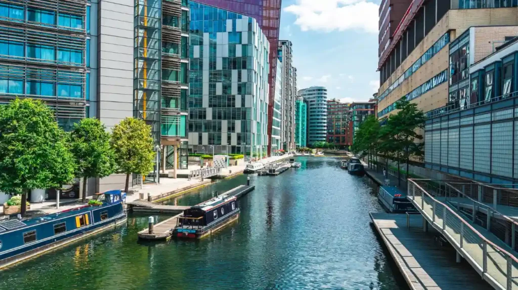
The Paddington Arm connected the Grand Junction Canal with a distribution point close to central London. Paddington Basin developed around canal access, warehouses and waterside commercial activity.
The area demonstrates how a historic freight destination can remain recognisable even after surrounding land uses change.
These landmarks form a useful starting point for exploring the canal’s physical history. Together, they connect the story of waterway engineering with the economic geography of West London.
How do canal locks, towpaths and bridges work?
Canal locks regulate water levels so boats can travel between sections at different heights. Towpaths provide routes alongside the water, while bridges carry roads, railways and pedestrians across the canal. These structures form the essential engineering framework of West London’s historic waterways.
A canal is an engineered waterway designed to carry boats along a controlled route. Its construction requires solutions to changes in elevation, crossings, water supply and the movement of vessels through confined spaces.
How does a canal lock operate?
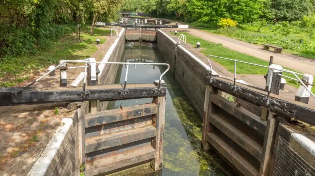
A lock is an enclosed chamber fitted with gates at either end. To raise a boat, the boat enters the chamber and the gates close behind it. Water enters until the chamber reaches the level of the higher canal section. The upper gates then open, allowing the boat to continue.
To lower a boat, the process is reversed. Water leaves the chamber until the level matches the lower section. The gates open when the water levels are equal.
The Hanwell Flight demonstrates how a series of locks enables boats to climb or descend a longer change in elevation. Each chamber manages a smaller difference in water level, making navigation possible through varied terrain.
Why are towpaths important?
A towpath is a path beside a canal that historically allowed people or horses to pull boats using ropes. Horse-drawn towing remained important before mechanised boats and tractors became widespread.
Today, towpaths serve walkers, cyclists and people travelling between nearby neighbourhoods. Their historic purpose explains their position close to the water and their continuity along long sections of the canal.
Towpaths also preserve the spatial relationship between the waterway and the communities that relied on it.
What role do bridges play?
Bridges maintain connections across canals without blocking navigation. Different bridge designs reflect the roads, railways and pedestrian routes that developed around the waterway.
Historic bridges provide evidence of changing construction techniques and transport priorities. Their height, shape and position also reflect the need to accommodate boats beneath them.
Together, locks, towpaths and bridges show that canal heritage involves an interconnected engineering system rather than isolated historic buildings.
How are West London’s canals connected to local communities?
West London’s canals influenced the growth of communities by attracting freight businesses, workers, warehouses and supporting services. Today, the same waterways connect neighbourhoods through walking routes, cycling corridors, waterside recreation and heritage activities that preserve links with the region’s industrial past.
The canal network formed part of the economic foundation of several West London neighbourhoods. Brentford developed around river and canal transport, while Hanwell, Southall, Hayes and areas near Uxbridge became connected to a wider waterway corridor.
Canals did not develop these communities in isolation. Roads, railways, factories, housing and markets also shaped their growth. The waterways nevertheless provided a lasting transport route that influenced where businesses operated and how goods reached their destinations.
What is the connection between canals and Brentford?
Brentford occupies a strategic position where the Grand Union Canal meets the Thames. This connection supported the transfer of goods between inland waterways and river transport.
Brentford Gauging Lock, Thames Lock and historic freight sites preserve evidence of that role. The canal’s industrial history is also visible in the relationship between its waterside structures and the town’s former commercial activity.
How did the canal affect Hayes and Southall?
The Grand Union Canal passes through an area that experienced major changes in industry, transport and urban development. Its route provided access to markets and freight connections for businesses operating in West London.
The canal corridor near Southall includes the Hanwell Flight, where historic engineering remains part of the local landscape. The wider route also provides a connection between urban neighbourhoods and waterside green spaces.
Why is canal heritage relevant to residents today?
Canals provide a physical link between local history and present-day neighbourhoods. Residents encounter this history when using towpaths, crossing historic bridges or passing former industrial sites.
The waterways also support educational activities. The Canal & River Trust provides opportunities for school groups to explore lock operation, water safety, birdlife and local heritage at selected West London locations.
For local communities, canal heritage therefore combines historic preservation with everyday public access and outdoor learning.
What happened to West London’s canals after commercial freight declined?
West London’s canals adapted as road and rail transport reduced their traditional freight role. Their historic infrastructure remained in place, while waterways increasingly supported leisure boating, walking, cycling, wildlife conservation, heritage education and the regeneration of former industrial areas.
The decline of commercial canal transport was gradual rather than instantaneous. Some cargo movements continued after railways and roads had become major competitors. Building materials and waste remained relevant to parts of the canal economy during the twentieth century.
The creation of the Grand Union Canal Company in 1929 reflected an attempt to strengthen the waterways through consolidation and modernisation. Nationalisation followed in 1948, when the British Transport Commission took over the company and its subsidiaries. Regular commercial activity subsequently declined across much of the network.
How did canals become recreational spaces?
As freight activity diminished, canal towpaths became increasingly important for public recreation. Walking, cycling, boating and fishing developed as prominent uses of inland waterways.
In West London, the canal corridor offers routes through urban neighbourhoods and areas of green space. Brentford’s towpath, for example, provides access to Thames Lock and the surrounding waterside landscape.
Recreational use gives historic infrastructure a continuing practical role. Locks still operate, boats still navigate suitable sections, and towpaths retain their relationship with the water.
How did urban regeneration change canal-side areas?
Urban regeneration is the process of improving and redeveloping areas experiencing economic or physical change. Canal-side regeneration often involves converting former industrial land into housing, workplaces, public spaces and commercial premises.
Paddington Basin illustrates the changing relationship between historic waterways and modern development. Its origins as a canal distribution area remain relevant to understanding the surrounding urban landscape.
Brentford also demonstrates how former freight locations sit within a changing townscape. Historic industrial structures and canal infrastructure provide context for understanding the transition from goods transport to contemporary waterside uses.
Regeneration presents a preservation challenge. New buildings and public spaces need to respect historic structures, navigation requirements and the character of the canal corridor.
What wildlife and environmental value do West London’s canals support?
West London’s canals provide linear habitats through built-up neighbourhoods, supporting aquatic life, water birds and waterside vegetation. Their towpaths connect green spaces and offer opportunities for nature observation, although habitat quality depends on water conditions, vegetation management and human activity.
Canals are engineered for navigation, but they also function as ecological corridors. Their water, bankside plants and adjoining green spaces create habitats within densely developed urban areas.
The Canal & River Trust includes wildlife observation and environmental learning in its West London educational activities. Visitors at sites such as the Hanwell Flight can learn about water birds alongside canal history and engineering.
Which wildlife can visitors look for?
Water birds are among the most visible forms of canal wildlife. Depending on location and season, visitors can look for mallards, coots, moorhens and other birds associated with freshwater environments.
Fish and aquatic invertebrates occupy the water, while waterside vegetation provides cover and feeding areas for smaller animals. Species presence varies with habitat conditions and water quality.
Wildlife observation is best approached without disturbing animals. Visitors should avoid feeding birds unsuitable food, leaving litter or entering restricted bankside areas.
How do canals contribute to urban green infrastructure?
Green infrastructure refers to connected natural and semi-natural spaces that provide environmental benefits within settlements. Canal corridors contribute by linking parks, gardens, waterside vegetation and other habitats.
Towpaths also encourage walking and cycling, giving residents access to outdoor routes without requiring a visit to a large park. This combination of transport, recreation and ecological functions makes canals relevant to urban planning.
What environmental pressures affect historic canals?
Canal environments face pressures from litter, pollution, invasive species, habitat disturbance and intense recreational use. Water levels and maintenance activities also affect habitats.
Responsible management must balance navigation with biodiversity. Maintaining locks, banks and towpaths protects the historic waterway, while suitable vegetation and pollution prevention help preserve its ecological value.
Canal heritage therefore includes both the built environment and the living habitats that have developed around it.
Explore More Area Guide
West London Industrial Heritage: Park Royal, Hayes and Brentford
Abandoned and Forgotten Places in West London
How can visitors explore West London’s canal heritage?
Visitors can explore West London’s canal heritage through towpath walks, historic locks, waterside landmarks and educational visits. Brentford, Hanwell, Southall, Uxbridge and the Paddington Arm offer different perspectives on canal engineering, industrial history and the relationship between waterways and urban communities.
A canal heritage visit does not require a boat. Many historic features are visible from public towpaths, bridges and nearby streets.
The best route depends on whether the visitor wants to focus on industrial landmarks, canal engineering, wildlife or a longer waterside walk.
Start near Brentford Gauging Lock and explore the canal’s connection with the Thames. Look for the historic locks, watch passing boats and consider how cargo moved between inland waterways and river transport. The Canal & River Trust provides local visitor information for this area.
Explore the Hanwell Flight to understand how locks manage differences in water level. Observe the relationship between the canal, towpath and surrounding green spaces. This section is suitable for combining local history with wildlife observation.
Visit the canal corridor around Uxbridge Lock to explore the engineering and navigation features of the wider waterway. Look at the lock gates, bridges and waterside environment to understand how the canal connects different settlements.
Explore Paddington Basin to see how a historic freight destination became part of a modern urban district. Consider the role of warehouses, loading facilities and canal access in the original development of the area.
How should visitors prepare for a canal heritage walk?
Check access information and route conditions before setting out. Towpaths vary in surface, width and accessibility, and some sections have narrow passages or uneven ground.
Visitors should remain aware of moving boats, cyclists and lock operations. Keep dogs under control, respect private moorings and follow any signs governing access.
For a history-focused visit, read the Canal & River Trust’s local information before travelling. Its West London education page identifies Uxbridge Lock, the Hanwell Flight and Brentford Gauging Locks as heritage learning locations.
Why does West London’s canal heritage matter for the future?
West London’s canal heritage matters because it preserves evidence of industrial development, historic engineering and community life while supporting recreation and urban biodiversity. Protecting locks, towpaths, warehouses and waterside habitats keeps this transport history relevant to future generations.
The canal network is a continuing part of West London’s physical environment. Unlike a historic building that records one site’s history, the canal links many neighbourhoods through a shared infrastructure system.
Its heritage value rests on several connected features. Historic locks demonstrate engineering practices. Former wharves and warehouses document commercial activity. Towpaths preserve the relationship between transport and the landscape. Surviving waterway connections explain how London exchanged goods with the Midlands.
Why is conservation important?
Conservation protects historic structures and the evidence they contain. Canal maintenance must preserve navigation, manage water levels and address the condition of locks, bridges, banks and towpaths.
Local planning also has a role. Redevelopment near historic waterways needs to consider the setting of heritage structures and the continuity of the canal landscape.
Conservation does not require every site to remain unchanged. It requires change to respect the features that explain the waterway’s historical importance.
How can canal heritage support education?
Canals provide practical examples for studying industrial history, geography, engineering and environmental science. Students can observe how locks work, examine transport connections and investigate the relationship between urban development and waterways.
The Canal & River Trust’s West London educational programme uses local canal sites to teach children about water safety, local history, lock operation and wildlife.
These experiences connect classroom learning with physical evidence from the landscape.
What is the long-term significance of West London’s waterways?
The future value of the canal network depends on balancing historic preservation, safe public access, navigation, biodiversity and the needs of growing urban communities.
The waterways remain useful because they serve several purposes at once. They preserve a record of industrial Britain, provide outdoor routes through built-up areas and support environmental learning.
West London’s canal heritage is therefore more than a record of an older transport system. It is a living landscape in which industrial history, community identity, engineering and nature continue to intersect.
What is West London canal heritage?
West London canal heritage refers to the historic waterways, locks, bridges, towpaths, warehouses and industrial sites that shaped the region’s transport and economic development. The Grand Union Canal is central to this heritage.