

West London contains a connected network of rivers, streams, canals and urban watercourses that shape its geography, wildlife, local history and green spaces. The River Thames forms the area’s principal natural waterway, while the River uk/local/brent/">Brent, River Crane, River Colne, Stamford Brook and smaller tributaries drain residential districts, parks, wetlands and former agricultural landscapes. These waterways support freshwater habitats, influence flood management and provide walking routes through boroughs including Ealing, Hounslow, Hillingdon, fulham/hammersmith/">hammersmith-and-fulham/">Hammersmith and Fulham, and Richmond upon Thames.
- What Are the Main Rivers and Streams in West London?
- How Does the River Thames Shape West London?
- Where Does the River Brent Flow Through West London?
- What Is the River Crane and Where Does It Flow?
- What Is the River Colne and How Is It Connected to West London?
- Which Smaller Streams and Tributaries Flow Through West London?
- How Have West London’s Rivers Changed Through History?
- How Do Rivers and Streams Support Wildlife in West London?
- What Causes Water Pollution in West London’s Rivers?
- How Does Climate Change Affect West London’s Rivers?
- Where Can People Walk Along Rivers and Streams in West London?
- Which Organisations Protect West London’s Rivers and Streams?
- What Is the Future of West London’s Rivers and Streams?
Understanding West London’s rivers and streams requires looking beyond the Thames. Smaller rivers carry rainwater through urban catchments, connect wildlife habitats and reveal how London developed around water. Their channels reflect centuries of farming, industrial activity, housing construction, transport development and environmental restoration. Today, local authorities, environmental organisations and community groups work to improve water quality, restore river habitats and manage flood risks.
What Are the Main Rivers and Streams in West London?
West London’s main rivers include the Thames, Brent, Crane and Colne, alongside smaller tributaries and streams. These waterways drain different catchments, connect parks and wetlands, support aquatic wildlife and influence flood management across residential and commercial districts.
A river is a natural channel that carries flowing water across a landscape towards another river, a lake or the sea. A stream is generally smaller, although the distinction between a stream and a river does not follow one universal size threshold. A tributary is a watercourse that flows into a larger river.
West London contains watercourses with different geographical roles. The Thames forms the main regional river corridor. The Brent drains parts of northwest London and flows towards the Thames. The Crane system serves parts of west and southwest London, while the Colne drains areas around the western edge of Greater London.
Other waterways include the Yeading Brook, the Duke of Northumberland’s River and smaller tributaries that feed larger catchments. Some channels are natural, while others have been straightened, diverted, culverted or incorporated into historic water-management systems.
The Grand Union Canal and its branches also form part of West London’s wider water landscape. However, a canal is an artificial navigation channel rather than a natural river. Distinguishing rivers from canals helps explain how water moves through the region and how different waterways support recreation, transport and wildlife.
How Does the River Thames Shape West London?
The River Thames forms West London’s principal river corridor, passing through places including Richmond, Twickenham, Brentford and Chiswick. Its tidal and freshwater environments influence riverside habitats, historic settlements, recreation, navigation and flood management along the western approaches to central London.
The Thames is one of Britain’s most important rivers and a defining geographical feature of London. Its upper reaches begin in Gloucestershire, and the river travels east through southern England before entering the North Sea through the Thames Estuary.
In West London, the river provides a boundary, transport route and ecological corridor. Richmond, Twickenham, Brentford and Chiswick contain riverside paths, historic buildings, parks and public spaces connected to the Thames. The river also links West London with central London and communities farther upstream.
The Thames changes character along its course. Upstream sections contain freshwater habitats and riverbank vegetation, while the tidal Thames experiences changing water levels influenced by the North Sea. Tidal conditions affect riverbank management, navigation and flood risk in the lower reaches.
Why Is the Thames Important to Local History?
The Thames supported settlement, trade and transport long before modern roads and railways developed. Communities used the river for fishing, ferry crossings, water transport and access to markets. Riverside settlements grew around landing places, bridges, mills and trading activities.
Brentford developed at the confluence of the Thames and the River Brent. Its position made it an important crossing and transport location. Richmond and Twickenham developed distinctive riverside landscapes containing historic houses, gardens and public paths.
Industrialisation changed many stretches of the river. Wharves, factories, boatyards and other commercial facilities occupied riverside land. Modern redevelopment has transformed several former industrial areas into residential neighbourhoods, offices, cultural venues and public spaces.
What Wildlife Lives Along the Thames?
Thames habitats support fish, waterbirds, invertebrates and mammals. Species recorded in suitable stretches include grey herons, cormorants, kingfishers, mute swans and several freshwater fish. Otters have also returned to parts of the wider Thames catchment following improvements in environmental conditions.
Wildlife distribution depends on water quality, vegetation, disturbance and the availability of food and shelter. Reed beds, muddy banks, submerged plants and tree-lined sections provide different habitat functions.
Riverside visitors should avoid feeding wild birds inappropriate food, disturbing nesting areas or entering restricted habitats. Dogs should remain under control near wildlife, particularly where birds nest or small mammals shelter along the banks.
Where Does the River Brent Flow Through West London?
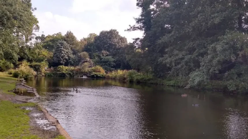
The River Brent drains parts of northwest London before joining the Thames at Brentford. Its catchment includes urban neighbourhoods, parks, tributaries and engineered channels, making it important for drainage, flood-risk management, river restoration and wildlife connectivity across West London.
The River Brent is a major tributary of the Thames. Its catchment extends across parts of northwest London and surrounding areas, collecting water from smaller streams and tributaries before the river reaches Brentford.
The river’s route connects green spaces and built-up districts. Sections pass through or alongside parks, playing fields, housing areas and transport corridors. This mixture of land uses affects runoff, riverbank conditions and the amount of space available for natural river processes.
The Brent has experienced substantial modification as London expanded. Engineers straightened and deepened sections, constructed flood-management infrastructure and confined parts of the channel within urban development. These interventions improved drainage or protected property in some locations but reduced natural river features in others.
How Does the River Brent Connect with the Thames?
The River Brent enters the Thames at Brentford, where the two waterways meet near an area shaped by historic transport and industry. The confluence explains Brentford’s geographical name and its longstanding relationship with river-based movement and trade.
Water from the Brent catchment ultimately enters the Thames system. Rainfall falling on roads, roofs, gardens and open land can reach the river through surface drainage, tributaries and groundwater pathways. The speed and volume of this runoff depend on soil conditions, rainfall intensity and the extent of impermeable surfaces.
What Is the Role of the Brent River Park?
Brent River Park is a network of green spaces associated with the River Brent in the London Borough of Ealing. It includes riverside landscapes used for walking, nature observation and informal recreation.
The park’s ecological importance comes from the relationship between open grassland, trees, riverbanks and connected green corridors. These habitats provide feeding and shelter opportunities for birds, insects and other wildlife.
River restoration within urban parks often focuses on improving bank structure, planting suitable vegetation, reducing erosion and creating more varied water flows. The effectiveness of individual projects depends on site conditions and long-term maintenance.
What Is the River Crane and Where Does It Flow?
The River Crane is a major watercourse in west and southwest London. It flows through areas including Hounslow and Richmond upon Thames before joining the Thames near Isleworth, linking urban neighbourhoods with parks, wetlands and riverside habitats.
The River Crane forms part of the wider Crane catchment, which includes tributaries and connected green spaces. Its course crosses a heavily urbanised landscape containing residential areas, roads, industrial land and public parks.
The river is particularly important because it retains stretches of accessible green corridor within a densely developed part of London. These spaces provide habitat continuity and opportunities for walking, environmental education and community conservation.
The Crane’s ecological condition varies by location. Some sections contain relatively natural banks and vegetation, while others show the effects of channel engineering, pollution pressures and surrounding development. River management therefore combines water-quality monitoring, habitat improvement and flood-risk reduction.
What Is the Crane Valley?
The Crane Valley describes the landscape associated with the River Crane and its connected habitats. It includes river corridors, woodland, grassland and wetland features that support wildlife across parts of Hounslow and Richmond upon Thames.
Crane Park is one of the best-known green spaces within this landscape. It contains riverbank habitats and areas used for walking and nature observation. Its location along the river makes it a useful place to understand the relationship between urban parks and freshwater ecosystems.
The Crane Valley also illustrates the importance of linked habitats. A single park provides local shelter and feeding areas, but a connected network of riverside vegetation allows wildlife to move between sites. Maintaining these links is particularly important where roads and buildings fragment the surrounding landscape.
Which Wildlife Depends on the River Crane?
The River Crane supports freshwater invertebrates, fish, waterbirds and other wildlife associated with flowing water and riverside vegetation. Kingfishers, grey herons and other birds use suitable stretches for feeding, while insects depend on aquatic and bank-side habitats.
Vegetated banks provide shelter for small animals and help stabilise soil. Trees shade parts of the channel, and fallen leaves contribute organic matter to the freshwater food web.
Water quality, barriers to movement and changes in river flow affect the species found in each section. Community monitoring and habitat restoration help identify problems and support improvements.
What Is the River Colne and How Is It Connected to West London?
The River Colne is a major tributary of the Thames that drains parts of Hertfordshire, Buckinghamshire and the western London fringe. Its network of channels, tributaries and associated wetlands influences the landscape around Hillingdon and neighbouring communities.
The Colne catchment extends across a broad area northwest of London. The river and its tributaries drain a mixture of countryside, towns, industrial districts and urban fringe landscapes before joining the Thames near Staines-upon-Thames.
The Colne is particularly relevant to West London because its catchment includes the Hillingdon area and neighbouring districts. Its waters and connected channels support freshwater habitats, while its floodplain provides space for water to spread during high-flow events where the landscape allows.
The river system contains a combination of natural channels and modified watercourses. Historic land drainage, milling, water supply and development altered several sections. These changes influence river flow, sediment movement and the distribution of habitats.
Why Are the Colne Valley’s Wetlands Important?
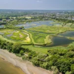
The Colne Valley contains lakes, wetlands, river channels and areas of open land across the western outskirts of Greater London. Some lakes originated from gravel extraction, while others reflect water-management and recreational uses.
Wetlands provide feeding and breeding habitat for waterbirds, amphibians, aquatic invertebrates and other wildlife. They also help store water and support ecological processes that differ from those found in fast-flowing river channels.
The Colne Valley Regional Park covers a wider landscape that includes waterways, reservoirs, lakes, countryside and recreational routes. It demonstrates how freshwater environments can remain important even where urban development has transformed surrounding land.
Which Smaller Streams and Tributaries Flow Through West London?
West London’s smaller waterways include Yeading Brook, the Duke of Northumberland’s River and tributaries associated with the Brent and Crane catchments. These channels carry local runoff, connect larger rivers and provide important drainage and habitat functions across built-up neighbourhoods.
Smaller watercourses often receive less public attention than major rivers, but they play a significant role in the region’s hydrology. They collect water from local catchments and convey it towards larger rivers, reservoirs or managed drainage systems.
Yeading Brook is associated with the River Brent catchment and flows through parts of northwest London and the western urban fringe. Its channels illustrate how a relatively small watercourse can connect residential districts, open spaces and flood-management landscapes.
The Duke of Northumberland’s River is a historic artificial watercourse in west London. It forms part of a wider network of water channels associated with the Crane and Colne landscapes. Its history reflects the longstanding use of water for land management and other practical purposes.
Other minor streams flow through parks, housing estates, golf courses and areas of open land. Some remain visible at the surface, while others pass through culverts beneath roads and buildings.
Why Are Some West London Streams Difficult to Find?
Urban streams frequently disappear from view because development covers their channels or redirects their flow into underground culverts. A culvert is a structure that carries water beneath a road, railway, building or other obstruction.
Culverting allows infrastructure to cross watercourses and makes more land available for construction. However, it often removes natural banks, reduces habitat variety and makes inspection or maintenance more difficult.
Historic maps, local river-group resources and environmental records help identify former stream routes. Restoring a buried or heavily modified watercourse requires technical assessments of land ownership, flood risk, utilities, water quality and available space.
How Do Tributaries Affect Flooding?
Tributaries respond to rainfall across their own catchments. During intense rainfall, water travels from roofs, roads, pavements and other surfaces into drainage networks and streams. Where runoff enters channels rapidly, river levels rise.
The combined flow from tributaries contributes to the water volume moving through a larger river. Flood risk depends on rainfall, soil saturation, channel capacity, barriers, floodplain availability and the performance of drainage infrastructure.
Natural flood-management measures include restoring floodplain connections, creating wetlands, planting suitable vegetation and slowing runoff where conditions allow. These measures complement, rather than automatically replace, engineered flood defences and drainage systems.
How Have West London’s Rivers Changed Through History?
West London’s rivers changed through agriculture, milling, industrialisation, urban growth and transport development. Channel straightening, culverting, water abstraction and drainage altered natural processes, while modern restoration projects seek to improve habitats, water quality and flood resilience.
Before extensive urbanisation, rivers and streams flowed through farmland, woodland, marshes and meadows. Seasonal flooding shaped fertile soils and maintained wetland habitats. Settlements developed near water for drinking supplies, farming, fishing, milling and transport.
During the medieval and early modern periods, people modified channels to operate mills, irrigate land and manage drainage. Artificial channels also supplied water to estates and supported agricultural activities.
Industrialisation increased the pressure on rivers. Factories and growing settlements generated wastewater, while transport infrastructure occupied river corridors. Population growth created additional demand for water and placed greater pressure on sanitation systems.
During the nineteenth and twentieth centuries, urban expansion covered many former fields and wetlands. Roads, housing and commercial development reduced permeable land, increased runoff and altered the shape of river channels. Some smaller streams were straightened or enclosed in culverts.
Modern environmental policy places greater emphasis on ecological condition, pollution control and sustainable flood management. River restoration projects seek to recover natural processes where feasible, improve habitat diversity and reconnect rivers with surrounding green spaces.
How Do Rivers and Streams Support Wildlife in West London?
West London’s rivers support wildlife by providing flowing freshwater, aquatic food sources, shelter and connected green corridors. Riverbanks, wetlands, ponds and wooded edges create habitats for birds, fish, insects, amphibians and mammals, with biodiversity depending on water quality and habitat condition.
A healthy river ecosystem contains relationships between water, sediment, vegetation and animals. Aquatic invertebrates feed on algae, leaf litter and other organic material. Fish consume invertebrates or smaller fish, while birds and mammals use aquatic habitats for feeding.
Riverbanks also provide terrestrial habitat. Trees and shrubs supply nesting sites, shade and shelter. Flowering plants support pollinators, while damp ground and shallow margins create suitable conditions for certain amphibians and insects.
Different habitats support different species. Fast-flowing sections, still-water margins, reed beds, wet grassland and shaded channels each offer distinct ecological conditions. A river corridor with varied habitats generally provides more ecological opportunities than a uniformly engineered channel.
What Is the Importance of Riverbank Vegetation?
Riverbank vegetation stabilises soil, reduces erosion and provides shelter for wildlife. Plant roots bind soil, while leaves and branches create shade and influence water temperature. Vegetation also intercepts some pollutants carried in surface runoff.
Trees contribute organic matter to freshwater ecosystems. Fallen leaves enter the water and support organisms that break down plant material. Insects emerging from rivers provide food for birds and bats.
Planting schemes must use species appropriate to local conditions. Poorly selected planting can obstruct maintenance or alter habitats. Conservation projects therefore consider native vegetation, flood conveyance, invasive species and the needs of existing wildlife.
How Do Rivers Connect Urban Green Spaces?
Rivers create linear corridors through built-up neighbourhoods. A connected corridor links parks, wetlands, gardens and other green areas, allowing wildlife to move between habitats.
The Brent and Crane systems demonstrate this function in West London. Their riverbanks connect several open spaces across local authority boundaries. These links provide ecological value even where individual habitat patches are small.
Connectivity also benefits people. Riverside paths provide walking routes, environmental education opportunities and access to nature. Responsible use requires keeping to designated paths where necessary and respecting protected or sensitive areas.
What Causes Water Pollution in West London’s Rivers?
Water pollution in West London comes from several sources, including road runoff, wastewater discharges, misconnections, litter and accidental spills. These pollutants affect aquatic organisms, water quality and public use, making monitoring, infrastructure maintenance and pollution prevention essential.
River pollution occurs when harmful substances or excessive quantities of waste enter a watercourse. The effects depend on the pollutant, its concentration, exposure time and the river’s flow conditions.
Urban runoff carries oil residues, tyre particles, metals, sediment and litter from roads and paved surfaces. Rainwater can transport these materials into gullies and drainage networks before they reach rivers.
Wastewater infrastructure also affects river quality. During certain conditions, storm overflows discharge diluted wastewater to prevent the sewer network from becoming overwhelmed. Such discharges can introduce sewage-related bacteria, organic matter and nutrients into receiving waters.
Misconnected household plumbing is another source of pollution. A misconnection occurs when a foul-water pipe, such as one carrying toilet or washing-machine wastewater, incorrectly drains into a surface-water system intended for rainwater.
Chemical spills, construction sediment and inappropriate disposal of household substances create additional risks. Reporting pollution quickly helps the responsible authorities investigate the source and assess the environmental impact.
How Is River Water Quality Monitored?
The Environment Agency monitors river conditions through sampling, inspections and other environmental assessment methods. Monitoring programmes examine factors such as chemical quality, biological indicators and ecological condition.
Measurements can include dissolved oxygen, nutrients, chemical pollutants and the presence of aquatic organisms. Biological communities provide evidence of longer-term conditions because different species tolerate different levels of pollution.
A single sample does not describe every condition in a river. Water quality changes with rainfall, temperature, discharge events and seasonal patterns. Reliable assessments therefore consider monitoring location, sampling dates and the methods used.
The Water Framework Directive established a framework for assessing and improving water bodies in the United Kingdom before the UK’s departure from the European Union. In England, river management now operates through domestic legislation and environmental regulations, including the Environment Act 2021 and the applicable water-environment regulations.
What Should Residents Do When They See Pollution?
Residents who observe a suspected pollution incident should record the location, time and visible characteristics from a safe position. Relevant details include unusual water colour, chemical smells, dead fish, foam or a visible discharge pipe.
The Environment Agency provides an official route for reporting environmental incidents in England. Immediate threats to life or serious emergencies require emergency services.
People should not enter polluted water or handle unknown substances. Photographs taken from a safe location help investigators understand the incident without exposing the observer to unnecessary risks.
How Does Climate Change Affect West London’s Rivers?
Climate change affects West London’s rivers through changing rainfall patterns, higher temperatures and increased pressure on flood-management systems. Intense rainfall raises surface-runoff risks, while hotter conditions can reduce water quality and place additional stress on aquatic habitats during low-flow periods.
Climate change influences both the amount and timing of water entering rivers. Heavy rainfall can overwhelm drainage systems and increase the speed at which water reaches channels. Long dry periods can reduce flows and concentrate some pollutants.
Urban areas face additional challenges because roofs, roads and pavements prevent rainfall from soaking naturally into the ground. Water reaches drains and rivers more quickly, particularly where there is limited green space or inadequate drainage capacity.
Higher water temperatures affect aquatic ecosystems. Warm water holds less dissolved oxygen than cold water, and some species experience stress when temperatures exceed their preferred range. Low flows can also reduce the dilution of pollutants.
Flood risk is not determined by climate alone. Land use, development, drainage maintenance, river-channel design and flood defences influence local outcomes. Effective adaptation combines updated flood-risk assessment with improvements to drainage, green infrastructure and river habitat.
How Can Natural Flood Management Help?
Natural flood management uses landscape features and processes to slow runoff, store water and reduce downstream pressure where conditions permit. Examples include wetland restoration, floodplain reconnection, sustainable drainage systems and carefully designed riverbank improvements.
Rain gardens, planted drainage features and permeable surfaces allow more rainwater to infiltrate or remain temporarily stored. Trees and vegetation intercept rainfall and improve soil structure, although their effects depend on the type of soil, weather and site design.
Wetlands and floodplains provide temporary water storage during high flows. They also support biodiversity and improve the quality of some runoff through sediment retention and biological processes.
These measures do not eliminate flooding. Their effectiveness depends on catchment scale, available land, rainfall intensity and how different interventions work together. They are most useful when integrated with drainage infrastructure, flood forecasting and emergency planning.
Where Can People Walk Along Rivers and Streams in West London?
West London offers riverside walking opportunities along the Thames, River Brent and River Crane, as well as routes through the Colne Valley landscape. Public paths connect parks, historic settlements and wildlife habitats, although access, path conditions and seasonal restrictions vary by location.
The Thames Path provides extensive walking opportunities beside the river. In West London, walkers can explore riverside sections around Richmond, Twickenham, Brentford and Chiswick. Routes pass historic buildings, open spaces, bridges and waterside businesses.
Brent River Park offers opportunities to follow sections of the River Brent through green spaces in Ealing. The experience varies by route, with open parkland and wooded stretches providing different views of the river corridor.
Crane Park and connected green spaces provide access to parts of the River Crane landscape. Visitors can combine a riverside walk with wildlife observation and exploration of local parks.
The Colne Valley offers a broader landscape of waterways, lakes, reservoirs and countryside paths around West London’s western fringe. Not every waterside location permits public access, so visitors should follow signed routes and respect private land.
Before setting out, check local council information and current path notices. Heavy rainfall can make riverside paths muddy or slippery, while flood conditions can temporarily close low-lying routes.
What Safety Rules Apply Near Rivers?
Rivers present risks from deep water, slippery banks, submerged objects, strong currents and sudden changes in water level. The Thames also contains tidal sections where water levels and currents change with the tide.
Walkers should remain on established paths and observe warning signs. Children require close supervision near water, and dogs should be controlled where paths pass close to steep banks or wildlife areas.
Swimming in an unfamiliar urban river is unsafe because currents, water quality and underwater hazards are difficult to assess. People should not assume that clear-looking water is safe for contact.
Anglers and boat users must follow relevant access rules, permits and navigation requirements. Conditions differ between the Thames, smaller rivers, canals and privately managed waters.
Explore More Area Guide
West London Nature Photography: Best Places to Visit Guide
Places to See Wildlife in West London: Parks and Nature Reserves
Which Organisations Protect West London’s Rivers and Streams?
West London’s rivers receive protection and management through public authorities, environmental charities, local river groups and water companies. The Environment Agency, Thames Water, local councils and organisations such as the River Crane Sanctuary and Thames21 contribute through regulation, infrastructure management, restoration and community engagement.
The Environment Agency regulates important aspects of the water environment in England, monitors river conditions and responds to environmental incidents. It also provides flood-risk information and warnings for areas exposed to flooding.
Thames Water operates water and wastewater infrastructure across much of London and surrounding areas. Its responsibilities include drinking-water supply, sewerage and wastewater treatment, alongside maintenance and investment in infrastructure.
Local councils manage parks, public paths, planning functions and aspects of surface-water management within their responsibilities. They also work with environmental organisations on local habitat improvements and public access.
Environmental charities and community groups contribute practical conservation work. Thames21 works on river and waterway improvement, community engagement and pollution-related projects. Local groups associated with the Brent and Crane catchments support monitoring, education and habitat restoration.
Residents contribute by reporting pollution, disposing of waste correctly, preventing household misconnections and participating in supervised conservation projects. Long-term river protection depends on coordinated work across entire catchments rather than isolated stretches.
What Is the Future of West London’s Rivers and Streams?
The future of West London’s rivers depends on improved water quality, climate adaptation, connected habitats and sustainable urban development. Restoration, pollution prevention, better drainage and public participation offer practical ways to protect the Thames, Brent, Crane, Colne and smaller local streams.
West London’s waterways face pressures from population growth, transport infrastructure, housing development, pollution and climate change. These pressures cross administrative boundaries because rivers transport water through connected catchments.
Future improvements require decisions that consider the whole river system. Development plans should account for floodplains, surface-water runoff, habitat connectivity and the capacity of existing drainage infrastructure. Protecting green spaces near rivers also helps maintain ecological corridors.
Water-quality improvements depend on preventing pollution at its source. Sewer upgrades, effective wastewater treatment, correct plumbing connections and responsible management of road runoff all contribute to healthier rivers.
River restoration offers further opportunities. Reintroducing varied channel features, improving riverbanks and reconnecting suitable floodplain areas can strengthen habitats and support more natural river processes. Projects require technical design, permissions and long-term monitoring to demonstrate results.
Public awareness remains important. Residents who understand how local streams connect to major rivers are better equipped to prevent pollution and support conservation. West London’s rivers are not separate features of the landscape; they form an interconnected system that supports wildlife, communities, recreation and flood management.
Protecting these waterways requires continued cooperation between public authorities, water companies, conservation organisations, landowners and residents. With effective planning and sustained investment, West London’s rivers and streams can remain valuable parts of the region’s environmental and cultural landscape.
What are the main rivers in West London?
The main rivers in West London include the River Thames, River Brent, River Crane and River Colne. These waterways support wildlife, provide riverside walking routes and play important roles in drainage and flood management.