

West London is a historic part of Greater London shaped by Roman roads, medieval villages, royal estates, rivers, canals, railways, industry, aviation and suburban expansion. The area includes historic communities such as uk/local/ealing/">Ealing, hounslow/brentford/">Brentford, Chiswick, fulham/hammersmith/">Hammersmith, Fulham, Acton, brent/wembley/">Wembley, Richmond, Kew, Hounslow, Southall and Heathrow.
- How far back does the history of West London go?
- How did Roman roads influence West London?
- How did West London develop during the Anglo-Saxon and medieval periods?
- Why was the River Thames important to West London’s history?
- How did royal estates shape the history of West London?
- When did West London become a centre of fashionable country houses?
- How did canals and improved roads transform West London?
- How did the railways change West London?
- How did industrialisation affect West London?
- Why is Wembley important to the history of West London?
- How did West London change during the 20th century?
- Why was Middlesex important to the history of West London?
- How did Heathrow change the history of West London?
- Which historic places best preserve West London’s past?
- How has migration shaped modern West London?
- How did West London become part of Greater London?
- What does the history of West London tell us about the area today?
The history of West London is closely connected with the historic county of Middlesex and the River Thames. Before modern borough boundaries existed, West London consisted largely of agricultural parishes, estates, villages and transport routes serving London and surrounding settlements.
Its development accelerated from the 18th century as improved roads, canals and river transport connected local communities with central London. The arrival of railways in the 19th century transformed rural settlements into suburbs. The 20th century brought mass housing, industrial estates, cultural change, wartime activity and Heathrow Airport.
Today, historic buildings, churches, parks, canals, royal sites, archaeological remains and street patterns preserve evidence of these different periods.
How far back does the history of West London go?
West London has evidence of human activity dating back thousands of years, with archaeological remains recording prehistoric settlement, Roman occupation, Anglo-Saxon communities and medieval agricultural villages before rapid urban development transformed the region.
The landscape now recognised as West London was not historically a single administrative area. It developed through separate settlements and parishes.
Archaeological evidence from the Ealing area indicates human occupation for more than 7,000 years. Permanent settlements expanded during the Anglo-Saxon period from around the 5th century onwards. The territory formed part of Middlesex, a historic county that remained an important administrative area until the creation of Greater London in 1965.
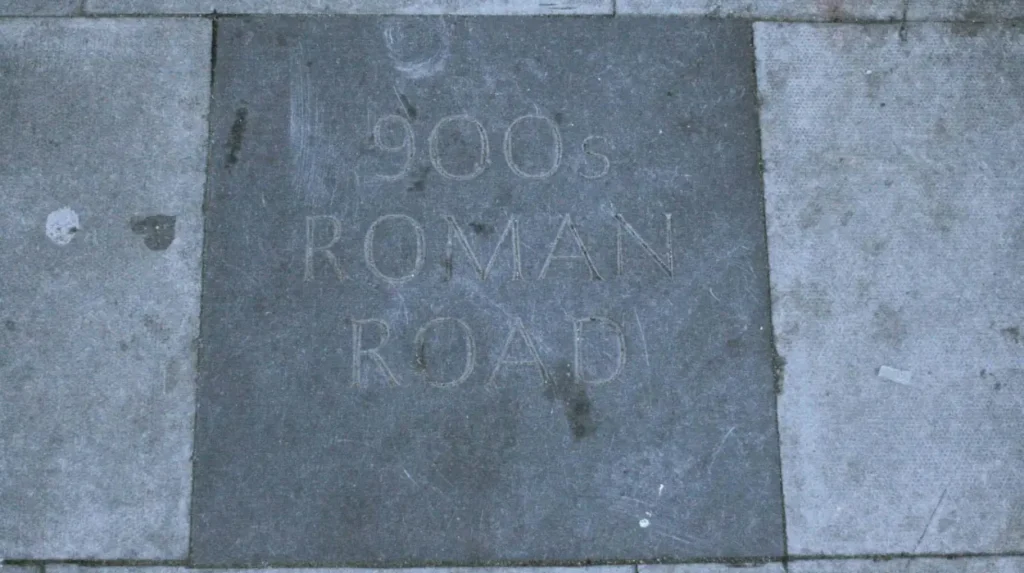
West London also contains evidence from the Roman period. Roman Britain began after the Roman invasion of AD 43. Roads provided important connections between settlements, military sites and Londinium, the Roman settlement that developed into London.
The modern Brent area provides particularly clear evidence of this period. Historic records identify a large Late Roman villa near Salmon Street in Kingsbury and another substantial Roman building near Dollis Hill. Watling Street, which followed the route of the modern Edgware Road through the wider area, was a major Roman road.
These archaeological remains demonstrate that West London was connected to wider networks long before the modern city expanded westward.
How did Roman roads influence West London?
Roman roads created durable transport corridors across West London, connecting settlements and agricultural areas with Londinium. Watling Street became one of the region’s most significant routes, while later roads frequently followed established Roman or medieval transport patterns.
Roads were fundamental to the development of West London because the region stood between London and settlements farther west.
Watling Street was particularly important. The road connected London with north-western Britain and passed through territory that later became part of Brent and neighbouring districts. Its route influenced later movement along the western side of London.
The Roman period also introduced villas and organised agricultural landscapes. A Roman villa was a substantial rural residence associated with agricultural production and land ownership. Evidence of Late Roman villas in Brent demonstrates the presence of organised settlement beyond central Londinium.
After Roman administration ended in Britain around AD 410, the region experienced major political and economic change. Settlement patterns shifted, while communities increasingly developed around agricultural land, churches, manors and local roads.
The survival of old routes is important because modern West London still contains roads and settlement patterns shaped by earlier transport networks.
How did West London develop during the Anglo-Saxon and medieval periods?
Anglo-Saxon and medieval West London developed as a landscape of villages, farms, manors, churches and religious foundations. Ealing, Wembley, Willesden, Kilburn, Hounslow, Richmond and other communities developed distinct identities before becoming part of modern Greater London.
Following the Roman period, Anglo-Saxon settlement expanded across Middlesex. Place names provide evidence of this development.
Brent preserves numerous Anglo-Saxon-derived names. Wembley derives from “Wemba lea”, meaning Wemba’s clearing. Neasden is associated with “Neosdune”, interpreted as the nose-shaped hill. Willesden derives from an early name associated with a hill and spring. Kingsbury is linked with “Cyngesbyrig”, meaning the king’s stronghold.
Medieval communities were generally organised around parishes, manors, farms and churches. Much of the land remained agricultural.
Religious institutions also shaped the landscape. Kilburn Priory was established in 1134 and became a stopping place for travellers and pilgrims. Inns later developed along the Edgware Road to serve people travelling through the area.
Richmond developed a particularly strong royal connection. The settlement was historically known as Shene. King Henry I resided there in 1125, and Edward I stayed there with his court in 1299. Edward II became direct owner of the Manor of Shene in 1312.
These royal connections established Richmond as one of the most important historic communities along the western River Thames.
Why was the River Thames important to West London’s history?
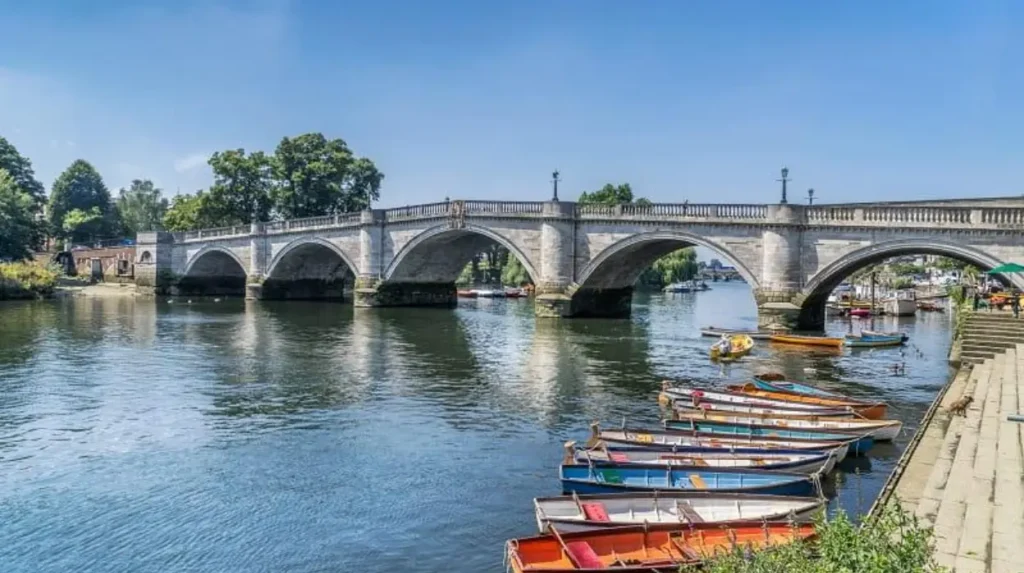
The River Thames provided West London with a major transport, trade and royal corridor. Settlements such as Richmond, Brentford, Chiswick and Hammersmith developed close to the river, while royal estates and later industrial activity strengthened the river’s economic and cultural importance.
The River Thames was one of the defining geographical features of West London.
Before modern roads and railways, rivers provided efficient transport for people and goods. Settlements beside the Thames therefore gained strategic advantages.
Brentford developed at the mouth of the River Brent, where the smaller river meets the Thames. Its location supported movement between inland Middlesex and the Thames.
Chiswick also developed as a riverside settlement. In the early 18th century, Chiswick remained a country village separated from the River Thames by fields. Its later transformation into a fashionable residential and cultural district reflected the growing influence of London and wealthy landowners.
Richmond became closely associated with the monarchy. Its royal history extends across approximately 900 years, beginning with medieval royal residences at Shene and continuing through later royal estates.
The Thames therefore connected several different aspects of West London history: agriculture, trade, transport, royal residence, recreation and later urban development.
How did royal estates shape the history of West London?
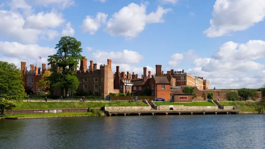
Royal estates influenced West London through land ownership, palace construction, landscape design, political activity and cultural development. Hampton Court, Richmond, Kew and other royal sites established long-term connections between the western suburbs, the monarchy and national history.
Royal influence is one of the strongest historical themes in West London.
Hampton Court Palace provides the clearest example. Cardinal Thomas Wolsey began transforming Hampton Court into a major palace during the early 16th century. Henry VIII later took possession of it, and the palace became an important Tudor royal residence.
Hampton Court also played a political role. The Hampton Court Conference of 1604 took place after James I became king. The discussions led to the creation of a new English Bible translation that became the King James Version.
Richmond developed another royal tradition. Medieval monarchs used Shene, later Richmond, as a royal residence. The site was repeatedly rebuilt and expanded by successive monarchs.
Kew became a royal centre during the Georgian period. Princess Augusta founded a nine-acre botanic garden at Kew in 1759. George III later united the Richmond and Kew estates, while Kew became a national botanical garden in 1840.
These estates left a physical legacy that remains visible in West London’s parks, gardens, palaces and architectural landmarks.
When did West London become a centre of fashionable country houses?
West London became increasingly associated with wealthy estates and country houses during the 17th and 18th centuries. Chiswick House, Kew’s royal estates and riverside properties demonstrate how affluent families used West London for residence, recreation, gardens and social activity.
Chiswick House is a major example of this transformation.
The estate was acquired by the Burlington family in the 17th century. Richard Boyle, 3rd Earl of Burlington, created the villa now known as Chiswick House between 1726 and 1729. Its architecture was influenced by Italian Renaissance architect Andrea Palladio and English architect Inigo Jones.
The surrounding gardens were equally significant. The landscape contributed to the development of the English landscape garden tradition, which later influenced garden design beyond Britain.
Kew developed in a different but connected way. Its royal associations encouraged the creation of landscaped grounds, botanical collections and architectural features.
William Chambers designed the Great Pagoda at Kew in 1762. Botanical collecting also expanded rapidly. Joseph Banks sent plants and seeds to Kew following voyages associated with the expansion of European scientific exploration.
The combination of royal patronage, wealthy estates and botanical science gave parts of West London an important cultural identity.
How did canals and improved roads transform West London?
Canals and improved roads transformed West London by reducing transport barriers, connecting agricultural districts with London markets and supporting industrial development. Better transport also encouraged residential growth as West London became increasingly integrated with the expanding capital.
The 18th and early 19th centuries brought major changes to transportation.
Turnpike roads improved important routes into London. Toll roads required travellers to pay charges for maintenance and improvement. The Harrow Road, for example, became a toll road in 1801. By 1826, two coaches travelled daily between the area and London.
Canals provided another transport network. The Grand Junction Canal, later incorporated into the Grand Union Canal, connected the western side of London with the national canal system. Brentford became an important junction because of its location beside the Thames.
Canal transport supported the movement of coal, building materials, food and manufactured goods. Industrial sites developed close to waterways because heavy goods were cheaper to transport by water than by road.
This transport infrastructure helped shift West London from a predominantly agricultural landscape towards a mixed industrial and residential region.
How did the railways change West London?
Railways transformed West London during the 19th century by reducing journey times, expanding commuter travel and encouraging housing construction. Stations created new development centres, while railway companies also supported industrial activity, employment and connections with central London.
The railway was one of the most important forces behind modern West London.
The London and Birmingham Railway reached Wembley in the 1830s. A railway line was built through the area in 1836–37, while Sudbury Station opened in 1842.
The Metropolitan Railway had an even stronger effect on northern West London. Willesden Green station opened in 1879. Willesden’s population subsequently increased from approximately 18,500 in 1875 to 140,000 in 1906.
Railways changed the geography of everyday life. Workers could live farther from central London while travelling into the city for employment.
Developers purchased farmland and created residential streets around stations. Terraced housing became a defining feature of many new suburbs.
Railway infrastructure also supported industry. Neasden became important for railway works and employment. The resulting combination of transport, housing and jobs accelerated suburbanisation.
How did industrialisation affect West London?
Industrialisation changed West London from an agricultural landscape into a mixed residential, commercial and industrial region. Factories, railway works, breweries, engineering businesses, food production and other industries created employment while accelerating population growth and urban expansion.
Industrialisation was uneven across West London.
Some communities retained substantial agricultural land into the 19th century. Others developed factories and warehouses close to railways, canals and roads.
Park Royal became an important industrial district. Industrial growth accelerated around Cricklewood and Park Royal during the early 20th century, supported by transport infrastructure and industries connected with wartime production and aviation.
Brentford also benefited from its transport location. Its position beside the Thames, roads and canal system supported manufacturing and distribution.
Hammersmith and Fulham developed strong industrial traditions close to the Thames and major transport routes. Breweries, engineering works and other businesses contributed to the area’s economic development.
Industrialisation also altered land use. Farms were replaced by housing estates, factories, roads and railway infrastructure.
This process explains why West London contains such a mixture of historic villages, Victorian terraces, industrial buildings, modern developments and surviving green spaces.
Why is Wembley important to the history of West London?
Wembley became one of West London’s most significant modern landmarks through railway development, the British Empire Exhibition, Wembley Stadium and large-scale suburban expansion. Its transformation illustrates the shift from rural Middlesex settlement to international sporting and cultural destination.
Wembley was still largely rural during the 19th century.
The Metropolitan Railway helped change this situation. In the early 20th century, railway entrepreneur Sir Edward Watkin promoted Wembley Park as a leisure destination and proposed a huge tower inspired by the Eiffel Tower. The unfinished structure was eventually demolished in 1907.
The biggest transformation came with the British Empire Exhibition of 1924 and 1925.
Approximately 27 million people visited the exhibition. Improved roads and public transport supported the huge crowds, while Wembley experienced rapid suburban development. The population increased from just 203 people in 1851 to 48,500 in 1931.
The Empire Stadium opened in 1923 and later became Wembley Stadium.
The site subsequently became associated with major sporting events, concerts and national celebrations. Wembley therefore represents a key transition from rural settlement to metropolitan destination.
How did West London change during the 20th century?
West London experienced rapid 20th-century urbanisation, wartime disruption, industrial expansion, mass housing and international migration. Former Middlesex communities became integrated into Greater London, while new transport infrastructure reshaped residential and economic patterns.
The early 20th century brought large-scale suburban expansion.
Acton, Ealing, Hammersmith, Fulham, Wembley, Willesden and neighbouring districts became increasingly urban.
The First World War increased demand for industrial production. Aviation and munitions industries expanded in several parts of West London.
The Second World War had a major impact. Willesden experienced more than 1,000 air raid warnings between 1939 and 1945 because of its industrial and railway infrastructure. Brent Council records 372 civilian deaths and 2,108 injuries in Willesden during the war.
Post-war development brought major changes in housing and population.
Industrial decline from the 1970s reduced employment in some traditional manufacturing areas. At the same time, West London continued to receive migrants from different parts of the world.
Brent became particularly diverse. Caribbean, Indian, East African Asian, Jewish and Irish communities contributed to the borough’s social and cultural development. By 1981, 37% of Brent’s population had been born outside the United Kingdom.
These migration patterns became a major part of modern West London’s identity.
Why was Middlesex important to the history of West London?
Middlesex provided the historic administrative framework for much of West London before Greater London was created. Its parishes, towns, rural districts and municipal boroughs formed the foundations of several modern London boroughs established in 1965.
Middlesex was historically a county surrounding much of western and northern London.
Communities including Ealing, Acton, Wembley, Willesden, Hounslow and other areas developed within this historic county.
The administrative structure changed as urbanisation accelerated. Ealing became a municipal borough in 1901. By 1961, Acton, Ealing and Southall operated as separate municipal boroughs within Middlesex.
The major administrative change occurred in 1965.
The historic Middlesex County Council was abolished, and large parts of the former county became part of Greater London. New London boroughs included Brent, Ealing and Hounslow, among others.
This change created the administrative geography used today.
However, the older Middlesex identity remains visible in historic buildings, archives, place names, parish boundaries and local heritage.
How did Heathrow change the history of West London?
Heathrow transformed West London into a major international aviation and employment centre after London Airport opened in 1946. Its development replaced a former rural landscape with one of the world’s most significant airport complexes and reshaped transport, employment and global connections.
Heathrow has roots in aviation history dating to the 1930s.
Aviation engineer Richard Fairey acquired 150 acres near Harmondsworth in 1930 to create an airfield for aircraft assembly and testing. The site became the Great West Aerodrome.
During the Second World War, the government requisitioned land around Heath Row for military aviation purposes.
After the war, the site was converted into a civil airport. The first commercial flight departed in 1946, and the airport officially opened that year. It was initially known as London Airport and was renamed Heathrow in 1966.
The airport expanded dramatically.
Early passenger facilities consisted of converted military marquees along the Bath Road. During its first operational year, approximately 63,000 passengers travelled through the airport.
By the 21st century, Heathrow had become a major international aviation hub. The airport marked its 80th anniversary in 2026, demonstrating the scale of its transformation from a small post-war airfield into a global gateway.
Which historic places best preserve West London’s past?
Historic places across West London preserve different periods of the region’s development, including Hampton Court Palace for Tudor and royal history, Kew Gardens for Georgian science, Chiswick House for 18th-century architecture, Wembley for modern mass culture and Heathrow for aviation history.
West London’s historical character is distributed across many sites rather than concentrated in one historic centre.
Hampton Court Palace preserves more than five centuries of royal history. Queen Victoria opened the palace to the public in 1838, and by 1881 more than 10 million visitors had been recorded.
Kew Gardens preserves the development of royal gardens and modern botanical science. The original botanic garden was founded in 1759, while Kew became a national botanical garden in 1840.
Chiswick House represents the architectural culture of the 18th-century aristocracy. Its neo-Palladian design and landscape gardens influenced British architectural and garden traditions.
Wembley represents the 20th-century transformation of West London into a centre for large-scale sporting and cultural events. The British Empire Exhibition brought approximately 27 million visits in 1924 and 1925.
Historic streets, churches, canals, railway stations, industrial buildings and surviving village centres add further layers to this heritage.
How has migration shaped modern West London?
Migration has been a major force in modern West London, especially since the mid-20th century. Caribbean, South Asian, East African Asian, Irish, Jewish and other communities transformed neighbourhoods, businesses, cultural institutions, food traditions and local identities.
The demographic history of West London reflects London’s wider development as an international city.
Brent provides strong evidence of this change. From the 1960s, the borough became one of London’s most ethnically diverse areas.
Caribbean communities established strong cultural connections in places such as Harlesden. Indian and East African Asian communities had major impacts on areas including Alperton and Ealing Road. Jewish communities also formed an important part of the population, while Irish migration had earlier connections with Kilburn and Cricklewood.
Migration changed the physical environment as well as population statistics.
Shops, restaurants, places of worship, community organisations and cultural events created new forms of local identity.
This history is particularly important when understanding contemporary West London. The region’s cultural landscape is the result of successive periods of settlement rather than a single historical tradition.
Explore More Area Guide
Hayes Restaurants: Best Places to Eat in West London
Neasden Fire: 125 Firefighters Tackle Hannah Close Blaze 2026
How did West London become part of Greater London?
West London became part of the modern Greater London administrative system in 1965, when the former Middlesex structure was reorganised. Boroughs including Brent, Ealing and Hounslow were created, establishing the framework for much of today’s West London.
The creation of Greater London marked the final major administrative stage in West London’s modern development.
Before 1965, local government was organised through counties, municipal boroughs, urban districts and parishes.
Willesden and Wembley were separate boroughs before joining to create the London Borough of Brent in 1965.
Ealing also underwent major administrative changes. Acton, Ealing and Southall were separate municipal boroughs in 1961 before becoming part of the new London Borough of Ealing.
The creation of Greater London did not erase the older identities of these places.
Ealing, Acton, Southall, Wembley, Willesden, Richmond, Kew, Chiswick, Hammersmith, Fulham, Hounslow and other communities retain distinctive historical characteristics.
Their modern identities therefore combine ancient settlement patterns, medieval institutions, Georgian estates, Victorian suburbanisation, industrial development, migration and post-war urban change.
What does the history of West London tell us about the area today?
The history of West London explains its present combination of historic villages, royal landmarks, suburban streets, industrial districts, cultural communities, transport corridors, green spaces and international infrastructure. Each layer reflects a different stage of the region’s long urban development.
Modern West London is the product of continuous change.
Roman roads established early transport corridors. Anglo-Saxon communities created place names and settlements. Medieval churches, manors and religious foundations structured local society.
Royal estates later transformed Richmond, Kew and Hampton Court into nationally important centres of political and cultural history.
The 18th and 19th centuries introduced landscaped estates, canals, turnpike roads, railways and industrialisation. Railway expansion converted rural communities into suburbs.
The 20th century added Wembley’s mass entertainment infrastructure, wartime industry, modern housing, international migration and Heathrow Airport.
The result is a region where different historical periods remain visible within a relatively compact part of London.
West London’s history therefore remains relevant to understanding its architecture, transport network, neighbourhood identities, cultural diversity, employment centres and visitor attractions. Its historical development also explains why modern West London contains such varied environments, from royal palaces and botanical gardens to railway suburbs, industrial estates, high streets, stadiums and one of the world’s major international airports.
How old is West London?
West London has evidence of human activity dating back thousands of years. Archaeological evidence records prehistoric activity, Roman occupation, Anglo-Saxon settlement and medieval communities.