

West London offers some of the most distinctive views of the River Thames, combining historic bridges, landscaped riverbanks, royal parkland, working waterways and established riverside neighbourhoods. From the elevated panorama at uk/local/richmond-upon-thames/richmond/">Richmond Hill to the riverside promenades of fulham/hammersmith/">Hammersmith and hounslow/chiswick/">Chiswick, the Thames provides a changing landscape for walking, photography, sightseeing and outdoor recreation.
- What makes Thames views in West London distinctive?
- The relationship between the river and West London’s geography
- Why the scenery changes along the Thames
- Where can visitors find the best panoramic Thames views in West London?
- Richmond Hill and the protected Thames panorama
- Richmond Terrace Gardens
- King Henry’s Mound in Richmond Park
- Choosing a viewpoint for different purposes
- Which West London riverside locations offer memorable Thames views?
- Richmond Riverside and Richmond Bridge
- Kew and the river near Kew Gardens
- Chiswick and Chiswick Mall
- Hammersmith riverside and Hammersmith Bridge
- Barnes and Fulham
- How has the River Thames shaped West London’s history?
- How historic crossings changed river communities
- Why historic buildings remain important to riverside scenery
- When is the best time to enjoy Thames views in West London?
- How can visitors explore Thames views along the Thames Path?
- Planning a short riverside route
- Combining river views with local attractions
- What should walkers know about river safety?
- What wildlife and natural landscapes can visitors see beside the Thames?
- Barnes Wetland Centre and birdwatching
- Petersham Meadows and Richmond’s green landscape
- Why riverside conservation matters
- How do Thames views contribute to West London’s tourism and local economy?
- Riverside hospitality and leisure
- Heritage tourism and local identity
- The value of accessible public spaces
- How can photographers capture the best Thames views in West London?
- Landscape and panoramic photography
- Architecture and bridge photography
- Practical photography considerations
- How can West London protect its Thames landscapes for the future?
- Flooding and changing river conditions
- Balancing development and landscape conservation
- Responsible tourism and community involvement
- Why should Thames views in West London be part of a local sightseeing itinerary?
The River Thames is one of England’s principal waterways and a defining geographical feature of London. In West London, its character changes between tidal riverbanks, green meadows, historic settlements and densely developed urban districts. These contrasts explain why Thames viewpoints attract residents, tourists, photographers, walkers and visitors interested in London’s history.
The Thames Path, a long-distance walking route following the river, connects many of these locations. Transport for London identifies landmarks along the route including Kew Gardens, Chiswick Pier, Barnes Wetland Centre, Syon Park and Teddington Lock. The route provides a practical way to explore West London’s riverside scenery on foot. Transport for London+1
What makes Thames views in West London distinctive?
Thames views in West London combine river landscapes, historic architecture, green open spaces and urban landmarks. The scenery changes from Richmond’s elevated countryside panoramas to Hammersmith’s bridges and Chiswick’s residential riverbanks, creating varied viewpoints for walking, photography, wildlife observation and sightseeing throughout the year.
The principal feature of West London’s Thames scenery is its geographical variety. The river passes through neighbourhoods with different histories, land uses and architectural styles. Some viewpoints overlook broad bends in the river, while others face bridges, historic buildings, landscaped gardens or boats moving along the water.
The relationship between the river and West London’s geography
The River Thames forms part of the geographical structure of southwest and west London. Its bends have influenced settlement patterns, transport connections, recreation and the development of riverside properties.
Richmond, Twickenham, Teddington, Barnes, Chiswick, Hammersmith and Fulham each provide different perspectives on the river. Richmond is particularly associated with elevated views and open landscapes. Hammersmith is recognised for its bridge and riverside walking routes. Chiswick combines residential streets, historic houses and quieter stretches of riverbank.
The landscape also reflects the interaction between natural processes and human development. Tides affect the river’s level and movement, while bridges, embankments, locks and paths influence how people access its banks.
Why the scenery changes along the Thames
Three geographical characteristics help explain the differences between West London’s viewpoints: elevation, river curvature and surrounding land use. Richmond Hill provides an elevated panorama across the Thames valley, while low-lying riverside paths offer views closer to the water. Curving sections of the river reveal different stretches of bank depending on the observer’s position.
The surrounding environment also determines the visual character of each location. Historic bridges frame the river in Richmond, mature trees provide shade near green spaces, and urban buildings create a more architectural setting around Hammersmith.
These variations make West London suitable for different types of outings, including short riverside walks, longer explorations along the Thames Path and photography focused on landscapes or historic structures.
Where can visitors find the best panoramic Thames views in West London?
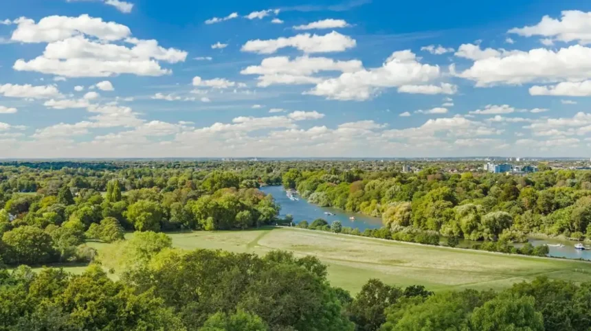
Richmond Hill is one of West London’s best-known panoramic viewpoints, overlooking the River Thames, Petersham Meadows and the surrounding valley. Other locations, including Richmond Terrace Gardens, King Henry’s Mound and riverside paths near Kew, provide different perspectives across water, parkland and London’s historic landscape.
Richmond Hill and the protected Thames panorama
Richmond Hill is a prominent elevated viewpoint in the London Borough of Richmond upon Thames. From the hill, visitors can see the river winding through Petersham Meadows, with green slopes and open land forming the foreground.
The view has a documented cultural history. The poet James Thomson, who lived in Richmond during the eighteenth century, wrote about the surrounding landscape in his poetry. The viewpoint subsequently became associated with landscape art and the literary history of the area.
The London Borough of Richmond upon Thames documents the view’s historical significance and its association with writers and artists. The panorama remains an important part of Richmond’s local identity. London Borough of Richmond upon Thames+1
Richmond Hill is particularly suitable for visitors seeking a broad landscape rather than a close-up view of the river. The elevated position makes the relationship between the Thames, meadows and surrounding settlements easier to appreciate.
Richmond Terrace Gardens
Richmond Terrace Gardens provide a landscaped public setting close to the elevated viewpoint. Their position connects the town centre with the broader landscape overlooking the Thames valley.
The gardens are useful for visitors who want to combine river views with a walk through Richmond’s historic streets. Nearby routes lead towards Richmond Riverside, where the scenery shifts from an elevated panorama to a waterside environment with boats, buildings and pedestrian paths.
King Henry’s Mound in Richmond Park
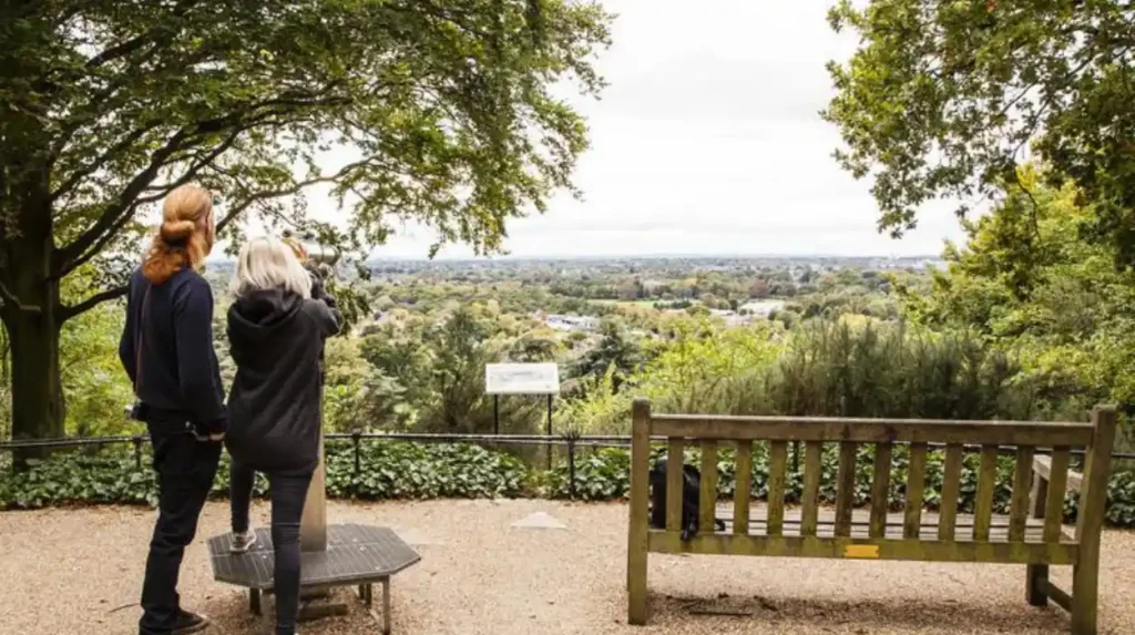
King Henry’s Mound is a historic viewpoint within Richmond Park, one of London’s major royal parks. The mound provides a protected sightline towards St Paul’s Cathedral in central London rather than a direct panoramic view of the Thames.
It remains relevant to a Thames-view itinerary because it demonstrates the relationship between elevated viewpoints, open parkland and London’s wider skyline. Visitors can combine it with other Richmond Park paths and the viewpoint on Richmond Hill.
A published walking guide describes a route of approximately 1.5 miles from Pembroke Lodge that includes viewpoints within Richmond Park, with an optional extension towards Richmond Hill. Actual walking time depends on stops and route conditions. richmondparklondon.co.uk+1
Choosing a viewpoint for different purposes
Richmond Hill is appropriate for broad landscape photography and sunset views. Terrace Gardens suit visitors who prefer a landscaped public space close to the town centre. King Henry’s Mound is more appropriate for parkland scenery and the protected London skyline.
These locations offer complementary experiences rather than identical views. Planning a visit around the desired scenery helps visitors choose a suitable route without covering unnecessary distances.
Which West London riverside locations offer memorable Thames views?
West London has several accessible riverside locations, including Richmond Riverside, Kew, Chiswick, Hammersmith, Barnes and Fulham. Each combines the Thames with a different setting, such as historic bridges, landscaped gardens, residential riverbanks, urban architecture or wildlife habitats, making them suitable for varied visits.
Richmond Riverside and Richmond Bridge
Richmond Riverside is a waterside area with pedestrian access, riverside businesses, boats and views across the Thames. It is suitable for visitors who want to experience the river alongside shops, cafés and historic architecture.
Richmond Bridge is a major landmark in this setting. Designed by James Paine and Kenton Couse, it opened in 1777 and was widened in 1937. Historic England identifies it as the oldest surviving bridge over the Thames within Greater London. Its Portland stone construction and five arches make it a recognisable feature of the riverside landscape. Historic England+1
The bridge provides opportunities to photograph the river from different angles and to observe the relationship between historic infrastructure and the surrounding town.
Kew and the river near Kew Gardens
Kew is known for its botanical heritage and proximity to the Thames. The Royal Botanic Gardens, Kew, is a major scientific and horticultural institution, while nearby riverbanks provide a separate opportunity to experience the water and its surroundings.
Views near Kew Bridge and adjoining riverside paths combine the river with residential buildings, bridge structures and tree-lined sections. Visitors can combine a river walk with a visit to Kew Gardens, subject to the gardens’ admission arrangements and opening times.
The riverside and botanical garden should be treated as distinct attractions. A walk along the river does not automatically provide entry to the gardens, and visitors should check access arrangements before planning both activities.
Chiswick and Chiswick Mall
Chiswick offers residential riverside scenery with historic houses, mature trees and views across the water. Chiswick Mall is a particularly notable stretch because of its traditional riverside buildings and its position beside the Thames.
The area provides a quieter alternative to heavily visited central London attractions. The combination of historic architecture and direct river frontage makes it useful for photography and neighbourhood walks.
Chiswick Pier also appears among the Thames Path’s recognised sights, linking the neighbourhood with the wider riverside route. Transport for London+1
Hammersmith riverside and Hammersmith Bridge
Hammersmith provides a more urban perspective on the Thames. The river lies along the southern edge of the neighbourhood, while the surrounding district contains transport connections, residential streets, entertainment venues and established riverside pubs.
Hammersmith Bridge is an important visual landmark. Its distinctive structure creates a strong focal point for river photography, while the adjacent paths allow visitors to observe boats and changing light on the water.
The riverside is suitable for shorter walks and visits that combine architecture with food, drink or nearby cultural attractions. Access conditions around the bridge and river paths should be checked before travelling, especially when maintenance works or restrictions affect pedestrian routes.
Barnes and Fulham
Barnes provides views of the Thames in a setting associated with residential streets, open spaces and wildlife. The nearby London Wetland Centre offers a separate nature-focused attraction where visitors can explore wetland habitats and observe birds.
Fulham’s river frontage combines residential neighbourhoods, sports heritage and green spaces. Craven Cottage, the home ground of Fulham Football Club, stands beside the Thames, while Bishop’s Park offers public green space close to the river. visitlondon.com+1
These locations are useful for visitors who want to combine riverside scenery with nature observation, park visits or local history.
How has the River Thames shaped West London’s history?
The Thames shaped West London’s history by supporting transport, trade, fishing, settlement and recreation. Historic bridges connected communities, riverside estates developed along its banks, and later railways and urban growth transformed the landscape. These changes remain visible in historic crossings, waterfront buildings and surviving open spaces.
The Thames has long served as a transport corridor through the London region. Before modern road networks became dominant, boats and ferries connected communities on opposite banks, while riverside settlements developed around crossings, landing places and commercial activity.
The river also influenced the location of estates, gardens and country houses. In West London, the proximity of water and open land helped establish riverside areas as places for both residence and recreation.
How historic crossings changed river communities
Bridges transformed access between settlements on the Thames. Richmond Bridge, completed in 1777, is an important surviving example of eighteenth-century bridge engineering. Its design reflects the development of permanent crossings in an area where river transport and ferries had previously played important roles.
Historic England records that Richmond Bridge was widened in 1937. Its continued presence demonstrates how historic infrastructure has adapted to modern transport requirements while retaining architectural significance. Historic England+1
Railway development subsequently changed the river’s relationship with London’s expanding suburbs. Historic England records that Richmond’s first railway bridge was completed in 1848, during the early period of railway expansion across the Thames. The development of railway connections supported the growth of settlements beyond central London. Historic England+1
Why historic buildings remain important to riverside scenery
Historic houses, bridges, churches and waterfront buildings give West London’s riverbanks a recognisable architectural character. These structures also explain how communities used the river for transport, residence, commerce and leisure.
Richmond’s Georgian bridge, Chiswick’s historic riverside houses and the established waterfront around Hammersmith illustrate different stages of the area’s development. Their settings help visitors understand the connection between architectural heritage and the geography of the Thames.
Conservation policies protect important buildings and landscapes from inappropriate alterations. Listed-building protection under the Planning (Listed Buildings and Conservation Areas) Act 1990 applies to designated structures such as Richmond Bridge. The designation recognises special architectural or historic interest. Historic England+1
When is the best time to enjoy Thames views in West London?
The best time to enjoy Thames views depends on daylight, weather, tides and the type of scenery visitors want to experience. Morning provides softer light and quieter paths, late afternoon offers changing landscape colours, and clear evenings create opportunities for sunset photography from elevated viewpoints.
The Thames changes visually throughout the day. Sunlight affects the appearance of the water, buildings and trees, while cloud cover changes the contrast between the river and surrounding landscape.
Morning views and riverside walks
Morning visits are suitable for walkers, photographers and visitors seeking quieter public spaces. The lower angle of the sun creates softer light on some stretches of the river, while early activity often includes rowers, runners and people walking along the Thames Path.
Richmond Riverside, Chiswick and Hammersmith are practical options for morning outings because their riverside settings support short walks and longer explorations.
Sunset and evening photography
Richmond Hill is a recognised location for panoramic landscape photography. Late afternoon and sunset provide changing light across Petersham Meadows and the Thames valley, although the exact view depends on season, cloud cover and the position of the sun.
Riverside locations such as Richmond Bridge also provide opportunities to photograph historic structures against the evening sky. Visitors should check sunset times for their travel date and allow sufficient time to reach the chosen viewpoint.
Seasonal differences along the river
Spring brings fresh vegetation to parks and riverside gardens. Summer provides longer daylight hours for extended walks and outdoor dining. Autumn changes the colours of mature trees, while winter often provides clearer views through vegetation where leaves have fallen.
Seasonal conditions affect accessibility as well as appearance. Rain creates slippery paths, and low winter temperatures require suitable clothing. River levels and tidal conditions also influence the appearance of the banks, particularly in low-lying areas.
How can visitors explore Thames views along the Thames Path?
The Thames Path is a long-distance walking route that follows the river through West London and beyond. Visitors can use accessible sections to explore Richmond, Kew, Chiswick and neighbouring riverside districts, choosing short walks or longer journeys according to distance, weather and local access conditions.
The Thames Path connects natural landscapes, historic buildings, bridges and urban neighbourhoods. Transport for London describes its Walk London route as extending for 79.5 miles (128 kilometres), with sights including Syon Park, Chiswick Pier, Kew Gardens, Barnes Wetland Centre and Teddington Lock. Transport for London+1
Planning a short riverside route
Visitors who have limited time can focus on one riverside district rather than attempting a long-distance walk. Richmond offers a convenient combination of the bridge, riverside paths and the elevated viewpoint at Richmond Hill.
Chiswick suits visitors interested in historic riverside houses and quieter residential scenery. Hammersmith provides a more urban route with views of its bridge and nearby public spaces.
The best starting point depends on the intended destination and available transport. Checking railway stations, bus connections and path access before departure reduces unnecessary walking.
Combining river views with local attractions
The Thames Path works well as part of a wider West London itinerary. Visitors can combine a riverside walk with Kew Gardens, Richmond’s historic town centre, local parks or cultural attractions in Hammersmith.
A route should account for opening hours and separate admission requirements. Gardens, museums and historic properties do not necessarily share the same access arrangements as public riverside paths.
Walking distances also depend on the selected bank and any diversions. Visitors should consult current route maps rather than assume every section offers continuous access directly beside the water.
What should walkers know about river safety?
The Thames is a working river with changing water levels, tidal currents and areas of deep water. Visitors should remain on designated paths, observe warning signs and keep a safe distance from unprotected edges.
Children should remain under close supervision near the water, and dogs should be kept under control where required. Swimming in the river without appropriate local guidance is unsafe because currents, boat traffic and water quality create risks that are not always visible from the bank.
Check local notices after heavy rain or during river-related maintenance works. Wear footwear suited to the surface and weather, especially where paths become muddy or slippery.
What wildlife and natural landscapes can visitors see beside the Thames?
West London’s Thames banks support a mixture of riverside vegetation, wetland habitats, birds and other wildlife. Locations around Barnes, Richmond and Kew provide opportunities to observe these environments, while meadows, parks and nature reserves demonstrate how urban landscapes retain valuable habitats alongside a major river.
The river landscape includes more than open water. Mudflats, reedbeds, grassland, trees and managed green spaces create different habitats for wildlife. The availability of food, shelter and nesting areas influences which species use each location.
Barnes Wetland Centre and birdwatching
The London Wetland Centre in Barnes is a wetland nature reserve operated by the Wildfowl and Wetlands Trust. It provides managed habitats and facilities for observing birds and learning about wetland conservation.
It is distinct from a public riverside path, with its own visitor arrangements. Visitors interested in wildlife should check admission prices, opening times and seasonal activities before travelling.
Birdwatching requires patience and respectful observation. Binoculars help visitors identify birds without approaching nests or disturbing feeding areas. Wildlife activity changes with the seasons, weather and water conditions.
Petersham Meadows and Richmond’s green landscape
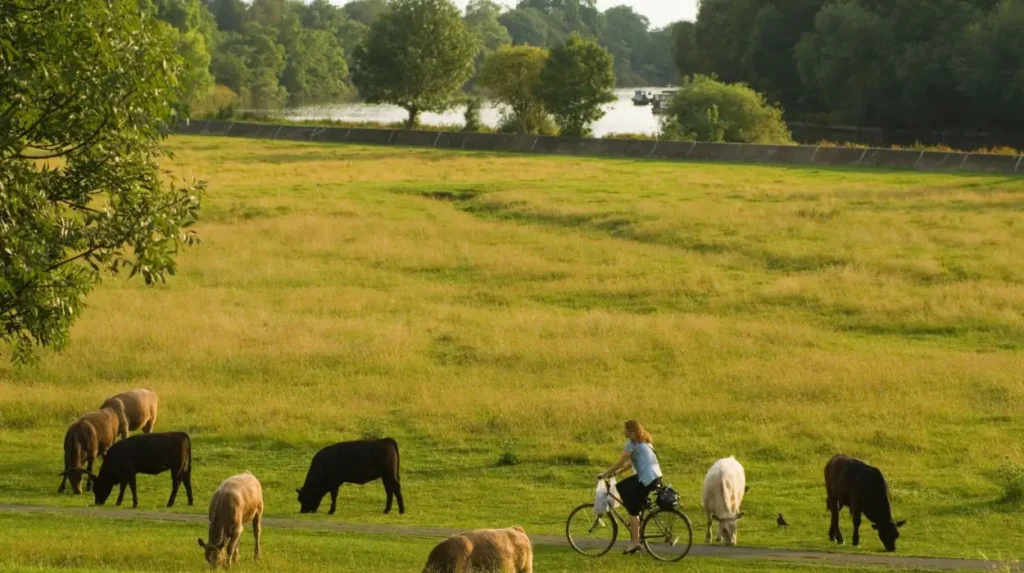
Petersham Meadows form part of the landscape visible from Richmond Hill. The open grassland creates a clear foreground between the viewpoint and the river, contributing to the area’s distinctive panorama.
The surrounding landscape demonstrates the relationship between open land and urban conservation. Protecting meadows and riverbanks maintains visual character while supporting plants, insects and other wildlife.
Visitors should respect access signs and land-management arrangements. Grazing animals and sensitive habitats require space, so walkers should avoid disturbing livestock or leaving litter.
Why riverside conservation matters
Riverbank vegetation can help stabilise soil, provide shelter for wildlife and contribute to the ecological quality of urban waterways. Wetlands also provide habitats for birds and aquatic organisms.
However, not every riverside area is a nature reserve. Some stretches are heavily developed or managed primarily for transport, housing and recreation. Conservation efforts therefore depend on local conditions and cooperation between landowners, councils, charities and community groups.
Responsible visits help protect these environments. Staying on paths, disposing of waste correctly and observing wildlife from a distance reduce disturbance to sensitive habitats.
How do Thames views contribute to West London’s tourism and local economy?
Thames views support West London’s visitor economy by attracting people to riverside cafés, historic attractions, public parks, boat trips and walking routes. These activities connect scenic landscapes with hospitality, leisure and heritage tourism, while public access to the river contributes to everyday recreation for local communities.
The Thames is both a landscape feature and a visitor destination. Its riverbanks connect places of historic interest with public spaces and commercial areas, encouraging visitors to explore beyond individual attractions.
Riverside hospitality and leisure
Richmond, Hammersmith and Chiswick contain riverside areas where visitors can combine walks with refreshments and local shopping. Restaurants, cafés and pubs benefit from their proximity to the water and the foot traffic generated by popular walking routes.
River cruises and boat trips offer another way to experience the landscape. Viewing the river from the water provides a different perspective on bridges, riverside properties and green spaces. Services, departure points and seasonal schedules vary, so visitors should check current operator information before booking.
Heritage tourism and local identity
Historic landmarks such as Richmond Bridge help connect the river landscape with London’s architectural history. Richmond Hill also attracts visitors interested in landscape art and the history of protected viewpoints.
These attractions support local tourism while giving residents opportunities to explore their area’s heritage. Public paths and viewpoints also provide lower-cost leisure options for people who prefer walking and photography to ticketed attractions.
The value of accessible public spaces
Public riverside paths support walking, exercise and outdoor recreation. They connect neighbourhoods and give residents access to natural scenery without requiring a journey to the countryside.
Accessibility varies between locations. Some routes have paved surfaces and nearby transport, while others contain uneven ground, steps or narrow sections. Visitors with mobility requirements should check route conditions before setting out.
How can photographers capture the best Thames views in West London?
Photographers can capture distinctive Thames views by selecting a viewpoint that matches their subject, checking daylight conditions and including recognisable landscape features. Richmond Hill suits panoramic photography, Richmond Bridge provides architectural compositions, and Hammersmith and Chiswick offer contrasting urban and residential riverside scenes.
Landscape and panoramic photography
Richmond Hill provides an elevated view across Petersham Meadows and the river valley. A wide-angle lens helps capture the relationship between the foreground, river and distant landscape.
King Henry’s Mound provides a different photographic subject, with its protected sightline towards St Paul’s Cathedral. Visitors should distinguish this skyline view from the direct Thames panorama at Richmond Hill.
Architecture and bridge photography
Richmond Bridge is suitable for photographs that emphasise historic stonework, arches and reflections. Hammersmith Bridge offers a contrasting structural subject within a more urban environment.
Photographers can explore different positions along publicly accessible paths to change the relationship between bridge, water and surrounding buildings. They should remain on permitted paths and avoid obstructing other users.
Practical photography considerations
A few simple preparations improve the results:
- Check daylight: Use sunrise or sunset times to plan landscape photography.
- Monitor the weather: Cloud cover, rain and mist change visibility and colour.
- Protect equipment: River spray and sudden rain require suitable protection for cameras and phones.
- Respect privacy: Avoid intrusive photography of people in private spaces or residential properties.
- Follow access rules: Do not enter restricted land or cross barriers to reach a preferred composition.
The best viewpoint is the one that matches the intended subject. Panoramas, historic architecture, wildlife and reflections require different positions and lighting conditions.
Explore More Area Guide
Boat Trips Around West London: Thames Cruises and Canal Tours
Riverside Cafés in West London | Thames & Canal Views
How can West London protect its Thames landscapes for the future?
Protecting West London’s Thames landscapes requires maintaining public access, conserving historic structures, managing riverside habitats and adapting to flooding and environmental pressures. Councils, conservation organisations, landowners and visitors all contribute to preserving the river’s scenic, ecological and recreational value for future generations.
The future of Thames views depends on both environmental management and the way riverside development is planned. The river is a dynamic environment influenced by rainfall, tides, land use and climate conditions.
Flooding and changing river conditions
Parts of the Thames are affected by tidal changes, and riverside areas face different levels of flood exposure. Flood risk depends on location, elevation, local defences and river conditions.
Visitors should follow official flood warnings and temporary access restrictions. People planning walks near low-lying banks should check current conditions, particularly after heavy rainfall or during periods of elevated water levels.
Balancing development and landscape conservation
West London’s riverside districts continue to accommodate housing, transport, hospitality and recreation. Development decisions affect public access, views of historic landmarks and the character of riverside streets.
Historic England’s records of protected structures, including Richmond Bridge, demonstrate the role of heritage designation in conserving important architectural features. Local planning and conservation policies also influence how buildings and landscapes change over time. Historic England+1
Maintaining established views requires attention to both individual landmarks and their wider settings. The relationship between the river, open land, buildings and skyline contributes to the character of each viewpoint.
Responsible tourism and community involvement
Visitors can support the river environment by avoiding litter, following access rules and respecting wildlife. Local conservation groups also contribute through habitat management, environmental education and community activities.
These actions help maintain the Thames as a shared resource rather than simply a scenic backdrop. The river’s future value depends on protecting its natural features while allowing residents and visitors to continue enjoying its public spaces.
Why should Thames views in West London be part of a local sightseeing itinerary?
Thames views deserve a place in a West London sightseeing itinerary because they connect historic landmarks, public parks, wildlife habitats and distinctive neighbourhoods. Richmond, Kew, Chiswick, Hammersmith and Barnes offer different experiences, allowing visitors to explore the river through walking, photography, heritage visits and outdoor recreation.
The Thames provides a geographical thread linking several of West London’s most recognisable places. Richmond Hill offers a celebrated panorama, Richmond Bridge represents historic engineering, and Hammersmith introduces a more urban riverside setting.
Further west, the river connects green spaces and historic neighbourhoods with gardens, meadows and wildlife habitats. These settings demonstrate that the Thames is not a single viewpoint but a changing landscape shaped by geography, history and everyday life.
Visitors can explore one location in a short outing or connect several destinations through the Thames Path. Checking transport, weather, access arrangements and attraction opening times helps make the experience more practical.
For residents, the river provides opportunities for regular walks and outdoor recreation. For tourists, it offers an alternative way to understand London’s history and landscape beyond its central landmarks. Protecting the river’s public spaces and heritage ensures that these views remain an important part of West London’s identity.
Where can you find the best Thames views in West London?
Richmond Hill is one of the best places for panoramic Thames views. Other popular locations include Richmond Riverside, Richmond Bridge, Chiswick Mall, Kew and Hammersmith riverside.